Labeled Chile Map – Chile is a South American country located on the western coast of the continent. It is bordered to the north by Peru, to the east by Bolivia and Argentina, and to the south by the Drake Passage and the Southern Ocean. Chile has a long and narrow shape, stretching over 4,300 kilometres from north to south, but only 177 kilometres at its widest point. The country has a diverse landscape, with the Andes mountain range running down its eastern border, the Atacama Desert in the north, and the Patagonian glaciers and fjords in the south.
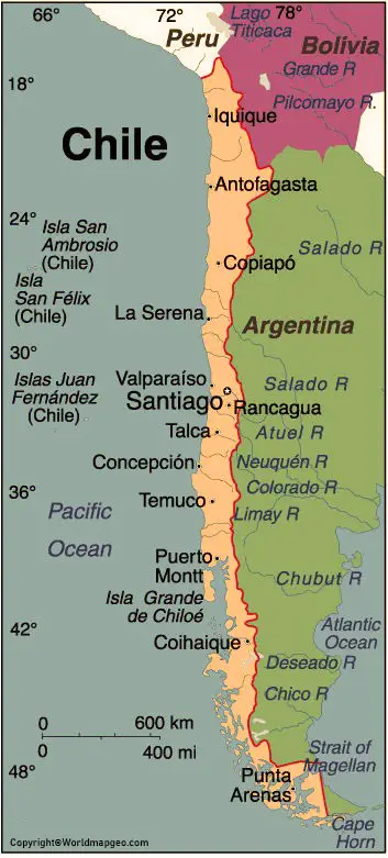
Labeled Chile Map
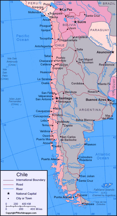
One way to better understand the geography of Chile is by looking at a labeled map of the country. A labeled map provides important information about the different regions, cities, and natural features of the country. In this article, we will explore some of the key elements of a labeled map of Chile.
Starting in the north of the country, we can see the Atacama Desert, which is the driest desert in the world. It spans a distance of over 1,000 kilometres and covers most of the northern part of Chile. Despite its arid landscape, the Atacama Desert is home to unique species of flora and fauna, as well as ancient indigenous cultures and pre-Columbian archaeological sites.
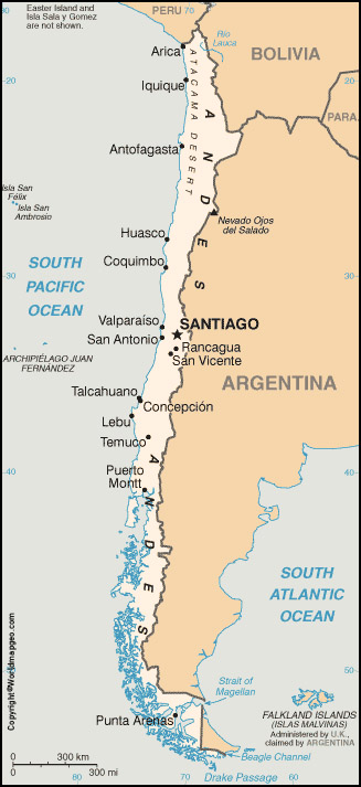
Chile Labeled Map With Capital
Moving south, we can see the city of Antofagasta, which is one of the largest cities in northern Chile. It is an important industrial center, with a large mining industry that extracts copper, gold, and silver from the nearby mountains. Antofagasta is also a popular destination for tourists, with its beautiful beaches, seafood restaurants, and cultural festivals.
Further south, we can see the city of La Serena, which is located in the Coquimbo Region of central Chile. La Serena is known for its colonial architecture, which has been well-preserved over the centuries. The city is also famous for its beautiful beaches, which are popular with both locals and tourists.
Continuing south, we can see the city of Santiago, which is the capital of Chile. Santiago is the largest city in the country and is the political, cultural, and economic center of Chile. The city is surrounded by the Andes mountain range, which provides stunning views and opportunities for outdoor recreation, such as skiing and hiking. Santiago is also known for its museums, parks, and vibrant nightlife.
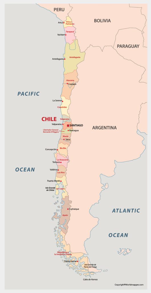
Labeled Chile Map With States
Moving even further south, we come to the Lakes Region, which is a popular tourist destination. The Lakes Region is known for its stunning natural beauty, with snow-capped mountains, pristine lakes, and lush forests. It is a popular destination for outdoor activities, such as fishing, kayaking, and hiking. Some of the major cities in the region include Puerto Montt, Osorno, and Valdivia.
Continuing south, we come to the Patagonian region of Chile, which is known for its glaciers, fjords, and rugged coastline. The region is home to some of the most stunning natural landscapes in the world, such as Torres del Paine National Park, which is a popular destination for hiking and wildlife watching. The major cities in the region include Punta Arenas, Puerto Natales, and Coyhaique.
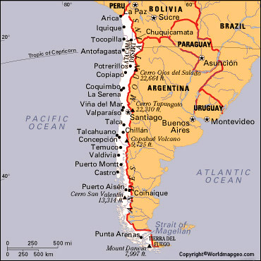
Chile Map With Cities Labeled
Finally, at the southern tip of Chile, we can see the city of Cape Horn, which is located on the island of Hornos. Cape Horn is the southernmost city in the world and is famous for its turbulent waters and extreme weather conditions. The city has a rich maritime history, with many shipwrecks and tales of daring explorers.
In addition to the cities and natural features of Chile, a labeled map can also provide important information about the country’s political divisions. Chile is divided into 16 regions, which are further subdivided into provinces and communes.
