Labeled Djibouti Map – Djibouti is a small country located in the Horn of Africa, bordered by Eritrea to the north, Ethiopia to the west and south, and Somalia to the southeast. Its location makes it a strategic point for international trade, as it sits on the Red Sea, which connects to the Indian Ocean. Djibouti has a land area of approximately 23,000 square kilometres and a population of over one million people.
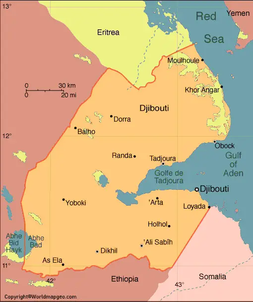
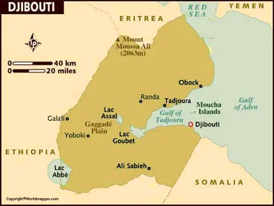
The country’s capital and largest city is also called Djibouti, located on the Gulf of Tadjoura. Other major cities include Ali Sabieh, Dikhil, and Tadjourah. The official languages of Djibouti are French and Arabic, with Somali and Afar also widely spoken.
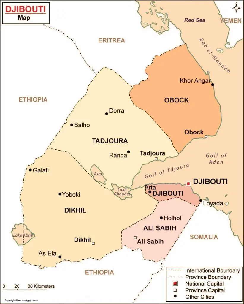
Labeled Djibouti Map

A labeled map of Djibouti would display the country’s major cities and physical features. The Gulf of Tadjoura and the Red Sea would be prominent features, as they have played a crucial role in Djibouti’s history and economy. The port of Djibouti is one of the busiest in East Africa, and it has become a major transhipment hub for goods travelling to and from neighbouring countries.
The country’s terrain is mainly composed of desert and semi-arid plains, with some mountains and plateaus in the central and southern regions. Lake Assal, the lowest point in Africa, is located in the Danakil Desert in the north-central part of the country. This salt lake is also one of the saltiest bodies of water in the world, with a salt concentration that is almost ten times higher than that of the ocean.
Labeled Djibouti Map With Capital
The map would also show the major ethnic groups in Djibouti. The two largest groups are the Somalis and the Afars, with smaller communities of Arabs, Ethiopians, and Europeans. The Somalis are mainly concentrated in the southern and central parts of the country, while the Afars live in the north and east. Both groups have distinct cultures and languages, with Somali and Afar being the most widely spoken.
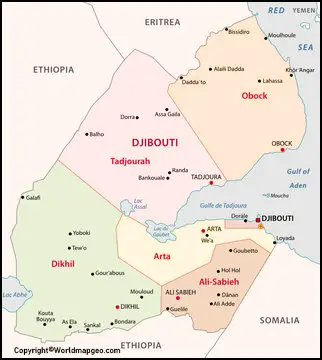
The country’s political subdivisions would also be shown on the map, including its six regions (Arta, Ali Sabieh, Dikhil, Djibouti, Obock, and Tadjourah) and the capital district. Djibouti is a republic with a semi-presidential system, with the president serving as the head of state and the prime minister as the head of government. The current president is Ismaïl Omar Guelleh, who has been in office since 1999.
Djibouti Map With States Labeled
In recent years, Djibouti has become a hub for international military operations due to its strategic location. The United States, France, China, and other countries have established military bases in Djibouti, contributing to the country’s economy and political stability. The map would show the location of these bases, including Camp Lemonnier, the largest US military base in Africa.
Djibouti faces several challenges, including poverty, unemployment, and political instability. The country’s economy relies heavily on foreign investment and trade, particularly with neighbouring Ethiopia. In recent years, the government has invested in infrastructure projects, such as the construction of a new port and railway system, to improve the country’s transportation and logistics capabilities. The map would show these key infrastructure projects, highlighting Djibouti’s importance as a trade gateway for the region.
Djibouti Map With Cities Labeled
Djibouti is a small East African country with a rich cultural heritage and diverse natural landscapes. While the country may not be as well-known as some of its neighbors, it offers a range of unique and fascinating places to visit. Here are some of the most famous places in Djibouti:
- Lake Assal – This is the lowest point in Africa and the saltiest lake outside of Antarctica. The lake is known for its stunning blue-green color and unique geological formations.
- Goda Mountains – Located in the Tadjoura region, the Goda Mountains offer breathtaking views of the surrounding landscapes, including valleys, plains, and the Gulf of Tadjoura.
- Moucha Island – This picturesque island is located off the coast of Djibouti and is a popular spot for snorkeling and diving. Visitors can explore the island’s crystal-clear waters and abundant marine life.
- Arta Beach – This beautiful beach is a popular destination for locals and tourists alike. Its white sand and turquoise waters make it a great spot for swimming and sunbathing.
- Ghoubbet al-Kharab – This bay is known for its unique geological features and is a popular destination for geologists and adventure travelers. Visitors can explore the area’s hot springs, salt pans, and underwater vents.
Overall, Djibouti offers a wide range of unique and fascinating places to visit, from stunning natural landscapes to historical landmarks and cultural attractions.
In conclusion, a labeled map of Djibouti would provide a visual representation of the country’s physical features, cultural diversity, and political subdivisions. It would also highlight the country’s importance as a strategic location for international trade and military operations.


