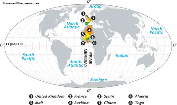
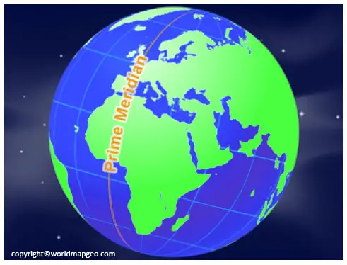
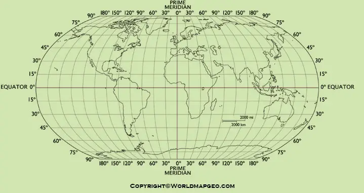
Prime Meridian Map: The user can understand the places identified on the Prime Meridian and the Equator using the world map with the prime meridian and Equator. The Equator and prime meridian depicted as two circles that extend around the globe. The Equator, located at 0 degrees latitude, separates the Northern and Southern hemispheres of the world map. The prime meridian divides the Western and Eastern hemispheres, as shown on the world map of the prime meridian. The prime meridian travels through England and Greenwich at an angle of 0 degrees latitude.
The Prime Meridian and Longitude is an angle from the Greenwich Meridian that points west or east. The Greenwich Meridian is regarded as the prime meridian based on theoretical understanding. Longitude is defined as 180 degrees east of the prime meridian and 180 degrees west of it.
Prime Meridian Map
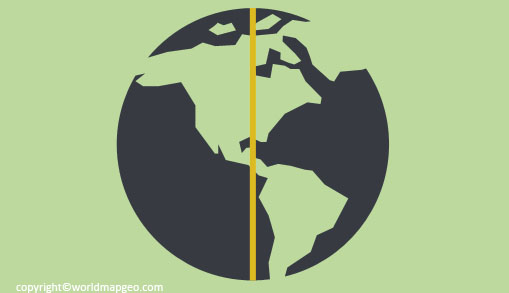
A Prime Meridian Map is a geographical representation that highlights the line of longitude known as the Prime Meridian. This meridian is the starting point for measuring longitude and is located at 0 degrees. It passes through the Royal Observatory in Greenwich, London, United Kingdom. The Prime Meridian divides the Earth into the Eastern Hemisphere and the Western Hemisphere.
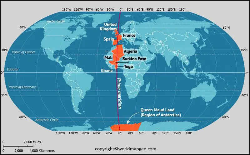
The map typically displays the Prime Meridian as a vertical line running from the North Pole to the South Pole, intersecting the Equator at a right angle. It serves as a reference point for determining the time and coordinating time zones worldwide. Alongside the Prime Meridian, the map often indicates the International Date Line, which lies exactly 180 degrees away, on the opposite side of the Earth. Check out other World Maps:- Printable World Map, World Map Continents and Oceans, 3D World Map.
For centuries, the Prime Meridian has played a crucial role in navigation and cartography. It helps sailors and pilots establish their positions, and it is also essential for modern technologies like GPS (Global Positioning System). Additionally, the Prime Meridian symbolizes the global connection between different regions and time zones, emphasizing the Earth’s unity despite its vast size and diverse cultures.
Prime Meridian Map with North Pole
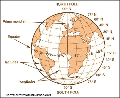
A Prime Meridian Map with the North Pole provides a comprehensive view of the Earth’s longitudes, with a particular emphasis on the starting point of the Prime Meridian at the topmost point of the planet. This map showcases the Prime Meridian as a vertical line that runs from the North Pole to the South Pole, dividing the Earth into the Eastern and Western Hemispheres.
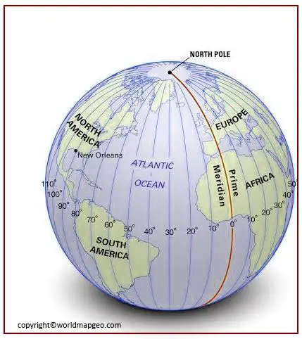
As the Prime Meridian is essential for determining longitude, its placement at the North Pole creates a natural reference point for navigators and explorers. Longitude is measured both to the east and west of this line, allowing travelers to pinpoint their exact locations and plan their journeys accurately.
In addition to the Prime Meridian, this map often features other crucial lines of longitude, such as the 180th meridian, which corresponds to the International Date Line. Together, these lines form a global grid system that facilitates accurate positioning and timekeeping worldwide.
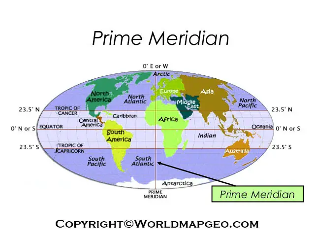
Prime Meridian on World Map
The Prime Meridian on a world map is a critical element for understanding the planet’s geographical layout and is an essential component of any map that depicts the Earth’s longitudes. This line of longitude, denoted by 0 degrees, is the starting point for measuring both eastward and westward coordinates around the globe.
Typically, the Prime Meridian on a world map is depicted as a vertical line running from the North Pole to the South Pole, passing through the Royal Observatory in Greenwich, London. Greenwich Mean Time (GMT) is based on this location and serves as the standard time used for coordinating time zones globally.
On the map, the Prime Meridian divides the Eastern Hemisphere, encompassing Europe, Africa, Asia, and Australia, from the Western Hemisphere, which includes the Americas and part of Antarctica. This division provides a clear reference point for understanding spatial relationships and time differences across the world.
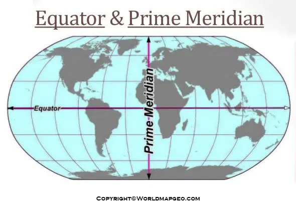
World Map with Equator and Prime Meridian
A World Map with the Equator and Prime Meridian offers a comprehensive view of the Earth’s major reference lines, making it an invaluable tool for navigation, geography, and timekeeping. The Equator, an imaginary circle located at 0 degrees latitude, divides the Earth into the Northern Hemisphere and the Southern Hemisphere. Meanwhile, the Prime Meridian, at 0 degrees longitude, separates the Western Hemisphere from the Eastern Hemisphere.
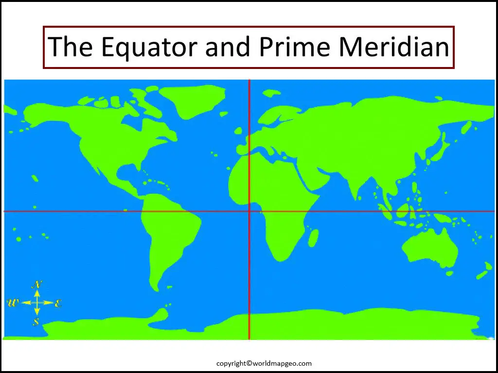
This map showcases the Equator as a horizontal line circling the Earth at its widest point, while the Prime Meridian is represented as a vertical line that intersects the Equator at a right angle. Together, they form a global grid system that enables accurate positioning and orientation.
In addition to its navigational significance, this map also helps us understand the Earth’s diversity in terms of climate, time zones, and cultural differences. Regions near the Equator experience a tropical climate, while areas closer to the poles have colder temperatures. Time zones established based on the Prime Meridian, with each 15-degree increment representing one hour of time difference.
World Map with Prime Meridian
A World Map with the Prime Meridian prominently displayed provides a clear reference for understanding the Earth’s longitudes and their impact on timekeeping and global navigation. The Prime Meridian, situated at 0 degrees longitude, serves as the starting point for measuring both eastward and westward coordinates on the planet.
On the map, the Prime Meridian is typically depicted as a vertical line running from the North Pole to the South Pole, dividing the Earth into the Eastern and Western Hemispheres. The line passes through Greenwich, England, home to the Royal Observatory, where the modern system of longitude measurement first established.
By incorporating the Prime Meridian into the world map, travelers, cartographers, and researchers gain a valuable tool for pinpointing locations and understanding the relationship between time zones. It also highlights the global interconnectedness of various regions and cultures, emphasizing that despite our geographical and cultural differences, we all share the same planet.
Furthermore, the Prime Meridian is an essential part of the global grid system, which allows us to precisely navigate across vast distances and coordinate international activities. Whether for historical exploration or modern-day travel, a World Map with the Prime Meridian remains an indispensable resource for understanding our world.