World Map Continents: The map depicts the continents, regions, and oceans of the planet. The Earth’s total surface area is 510 million km2, with 149 million km2 (29.2%) being “dry land” and the remainder covered by water. Shortly after leaving the forests, 6 million years ago, humans began naming their surroundings: Black Rock, Long Water, Dark Wood, WaterFall, Spring Field, Sea of Grass, Blue Mountain, Hippo Campus, etc.
Quick Facts –
| Feature | Information |
|---|---|
| Total Continents | 7 |
| Largest Continent | Asia |
| Smallest Continent | Australia |
| Largest Population | Asia |
| Coldest Continent | Antarctica |
| Most Countries | Africa |
| Largest Island Continent | Australia |
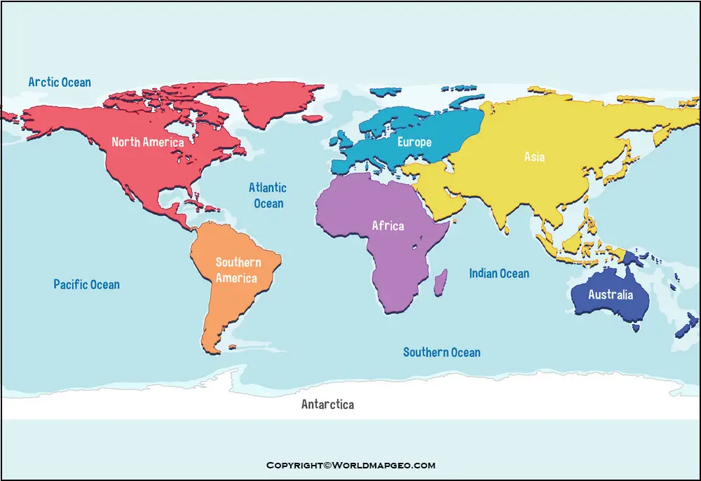
World Map: Continents and Oceans
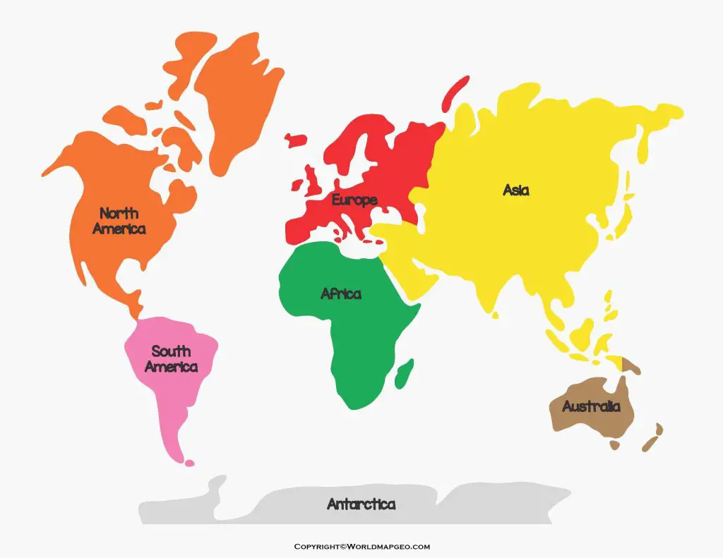
A world map is a powerful representation of our planet’s vastness and diversity. It showcases the continents and oceans that form the foundation of Earth’s geography. The continents, seven in total, are the large landmasses: Asia, Africa, North America, South America, Antarctica, Europe, and Australia. Each continent boasts unique cultures, landscapes, and histories, contributing to the global tapestry of human civilization.
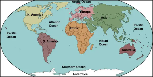
Interspersed between these continents are the great oceans that cover around 71% of Earth’s surface. The major oceans include the Atlantic, Pacific, Indian, Southern, and Arctic Oceans. These vast bodies of water play crucial roles in regulating the planet’s climate, sustaining marine life, and facilitating international trade and transportation.
Studying a world map with continents and oceans not only offers a visual appreciation of the planet’s scope but also helps us understand the interconnectivity between regions. It emphasizes how events in one part of the world can have far-reaching consequences across borders, fostering a sense of global citizenship and responsibility. Check out other World Maps:- World Map Blank, World Map Physical, Political World Map, Printable World Map.
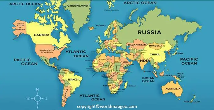
World Map Continents and Countr:ies
A world map displaying both continents and countries provides an insightful overview of the world’s political boundaries and territorial divisions. The continents, as the large land masses, remain the same as in the previous section: Asia, Africa, North America, South America, Antarctica, Europe, and Australia.
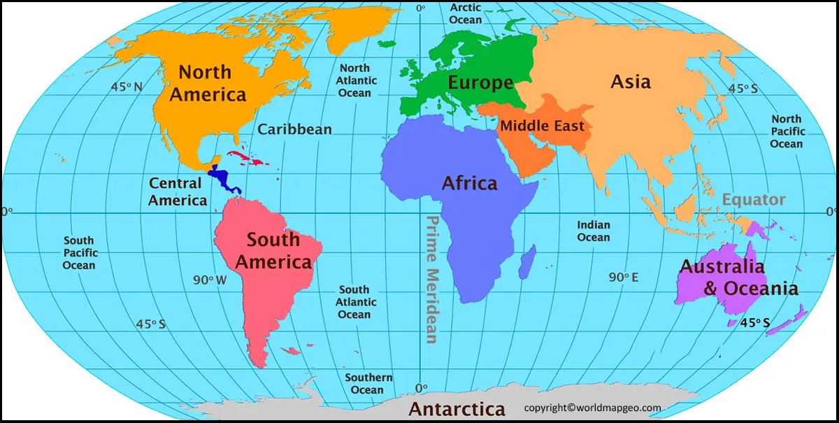
However, when delving into the world’s countries, one encounters a remarkable diversity. From populous nations like China and India to vast countries like Russia and Canada, each nation possesses a unique identity, culture, and governance system. These countries are further divided into states, provinces, or territories, showcasing administrative divisions that vary from place to place.
As we explore the world map with continents and countries, we gain an appreciation for the complex geopolitics and international relations that shape global interactions. Understanding the vast array of nations and their individual challenges and strengths helps promote cross-cultural understanding and cooperation on a global scale.
Which Continent Is the Largest?
Asia is the largest continent in the world, covering approximately 44.58 million square kilometers (17.2 million square miles), which is about 30% of Earth’s total land area. It is also the most populous continent, home to more than half of the world’s population. Asia includes 49 countries and is known for its diverse landscapes, ranging from the Himalayas and vast deserts to tropical rainforests and long coastlines. A world map with continents clearly shows Asia stretching from the Middle East in the west to the Pacific Ocean in the east.
Which Continent Has the Most Countries?
Africa has the highest number of countries of any continent, with 54 internationally recognized sovereign nations. These countries vary greatly in size, culture, language, and geography. Africa is home to famous landmarks such as the Sahara Desert, the Nile River, and the Serengeti. On a world map with continents, Africa is located south of Europe and is bordered by the Atlantic Ocean to the west and the Indian Ocean to the east. Its large number of countries makes it one of the most culturally and geographically diverse continents in the world.
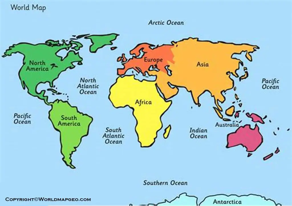
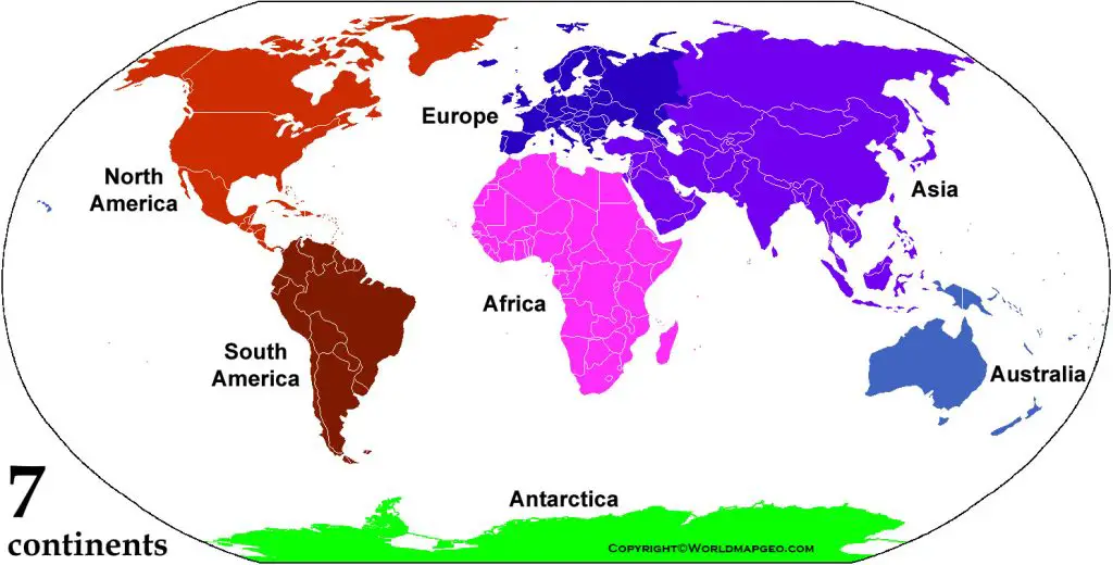
World Map 7 Continents with Names
The world map with the seven continents—Asia, Africa, North America, South America, Antarctica, Europe, and Australia—labeled provides an excellent educational resource for both children and adults alike. The names of these continents help learners identify and remember their locations, fostering a basic understanding of world geography.
Asia, the largest continent, is home to diverse cultures, languages, and landscapes, while Africa boasts a rich history and a vast array of wildlife. North America and South America are known for their vibrant societies, economic prowess, and breathtaking natural wonders. Antarctica, the coldest continent, is the realm of ice and scientific exploration. Europe, with its numerous countries and cultural heritage, remains a focal point of global politics and history. Australia, often referred to as a continent-country, flaunts unique flora, fauna, and Aboriginal culture.
Studying the world map with the continents labeled enables us to grasp the global distribution of landmasses, enhancing our knowledge of the world’s geography and encouraging curiosity about the diverse cultures and ecosystems that thrive on each continent.
World Map Black and White Continents
A black and white world map featuring continents brings simplicity and elegance to cartography. This minimalistic representation allows learners to focus solely on the outlines and shapes of the continents, helping them visualize the spatial arrangement without any distractions.
The continents, devoid of color, still retain their distinct identities. The rugged outline of Asia, the curvature of South America, the recognizable form of Africa, and the isolated beauty of Antarctica—all are easily discernible in black and white. This style of map also emphasizes the contrast between land and sea, showcasing the vast oceans that separate and connect the continents.
Such black and white world maps can be used for various purposes, from educational materials to artistic displays. They evoke a sense of wonder and curiosity about the world’s geography while providing a timeless representation of our planet’s physical features.
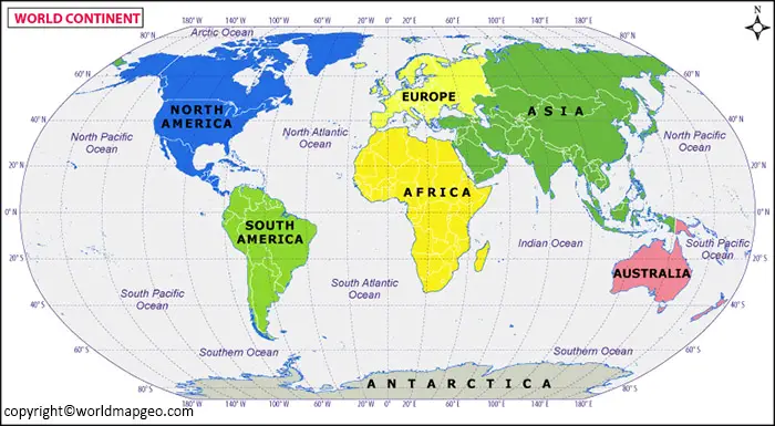
Labeled World Map Continents
A labeled world map with continents brings clarity and information to the viewer. Each continent is marked with its name, allowing learners of all ages to identify them effortlessly and understand their positions relative to each other.
The seven continents come alive on such a map. Asia, the largest and most populous continent, stretches from the Middle East to the Far East. Africa, with its distinctive shape, is known for its diverse cultures and abundant natural resources. North America and South America, connected by the narrow Isthmus of Panama, are home to bustling cities and stunning landscapes. Antarctica, the southernmost continent, is covered in ice and shrouded in mystery. Europe, steeped in history and heritage, showcases an array of languages and traditions. Australia, the smallest continent, boasts unique wildlife and a thriving multicultural society.
By studying a labeled world map with continents, we can foster a deeper appreciation for the world’s diversity and interconnectedness. It also serves as a starting point for understanding global issues and the interplay between geography and human civilization.
Printable World of the Map Continents
A printable world map featuring continents offers the flexibility to use it in various settings, be it in classrooms, homes, or offices. Such maps can be easily reproduced and distributed, making them valuable educational tools for teachers and parents alike.
These maps typically display the continents in vibrant colors, making them visually appealing and engaging for learners. The printable versions often include additional details such as country borders, major cities, and geographical features like rivers and mountains.
Using printable world maps of the continents encourages interactive learning experiences. Teachers can prompt students to mark specific countries, draw trade routes across continents, or locate natural wonders. Moreover, having physical copies of the map allows learners to explore the world at their own pace and delve into the fascinating aspects of global geography.
Blank Map World Continents
A blank world map featuring continents is a powerful resource for hands-on learning and assessment. By leaving the continents unlabeled, educators and students can engage in map-based activities that enhance geographical knowledge and spatial awareness.
When presented with a blank world map, learners can test their recall abilities by labeling each continent correctly. Such exercises improve memory retention and reinforce the visual representation of the continents’ shapes and positions.
Additionally, a blank map allows for customizations and customizations. Students can color the continents differently, add illustrations of landmarks, or create thematic maps. All of which contribute to a deeper understanding of global diversity and human interactions with the environment.
Blank world maps of continents also serve as valuable assessment tools. Educators can use them for quizzes, exams, or group activities. Encouraging collaborative learning and fostering a spirit of exploration among students.
Outline Map of World Continents
An outline map of the world’s continents offers a simplified depiction of their shapes, providing a clear visual understanding of their spatial arrangement. This minimalistic representation allows learners to focus solely on the contours of the landmasses without any distracting details.

Using an outline map, students can practice drawing the shapes of each continent, enhancing their spatial awareness and fine motor skills. It also serves as a foundation for understanding the concepts of latitude and longitude. As the positions of coThets are relative to the Equator and Prime Meridian.
The simplicity of the outline map makes it an excellent resource for introductory geography lessons or quick reference during classroom discussions. It offers an uncluttered view of the world’s continents, enabling learners to identify and recognize them easily.
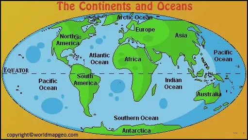
Map of seven continents of the world
A map specifically highlighting the seven continents of the world provides a clear and concise overview of Earth’s geography. Each continent is depicted with distinct colors and labeled, enabling quick identification and comprehension of their locations.
Starting with Asia, the world’s largest continent, learners can explore its vast territory, spanning from the Middle East to the Far East. It is known for its diverse cultures, ancient civilization and. And varied landscapes, from the towering Himalayas to the expansive Siberian plains.
Next, Africa stands out with its iconic shape, stretching from the Mediterranean Sea to the Cape of Good Hope. This continent boasts a rich tapestry of cultures, languages, and traditions. As well as being home to diverse wildlife, including the “Big Five.”
North America and South America are showcased side by side, separated by the narrow Isthmus of Panama. North America, with its mighty rivers, deep canyons, and impressive mountain ranges, houses economic powerhouses like the United States and Canada. South America, on the other hand, offers a remarkable display of biodiversity, with the Amazon Rainforest and the Andes Mountains dominating its landscape.
Related Post –
FAQs
1. Can I download a printable world map with continents?
Yes, many educational websites offer printable world maps with continents in PDF and image formats for school projects, classroom activities, and personal learning.
2. What are the names of the seven continents?
The seven continents are Asia, Africa, North America, South America, Antarctica, Europe, and Australia. A labeled world map with continents helps identify their locations.
3. Which is the largest continent in the world?
Asia is the largest continent, covering about 44.58 million square kilometers. It is also the most populous continent and spans a large part of the Eastern and Northern Hemispheres.
4. Which continent has the most countries?
Africa has the highest number of sovereign countries, with 54 recognized nations, making it the continent with the most countries.
5. Which is the smallest continent?
Australia is the smallest continent by land area. Despite its size, it is home to unique wildlife, diverse landscapes, and a highly developed economy.