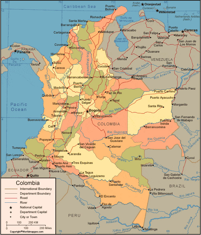
Labeled Colombia Map – Colombia is a vibrant country located in the northwest region of South America. The country is known for its diverse culture, breathtaking landscapes, and warm, welcoming people. In this article, we will explore Colombia through a labeled map that showcases its unique features and landmarks.
Labeled Colombia Map
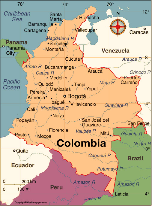
First and foremost, it is important to note that Colombia is the only South American country with coastlines on both the Pacific Ocean and the Caribbean Sea. The country is bordered by Venezuela, Brazil, Peru, Ecuador, and Panama. As we take a closer look at the map, we can see that the country is divided into 32 departments and one capital district, Bogota.
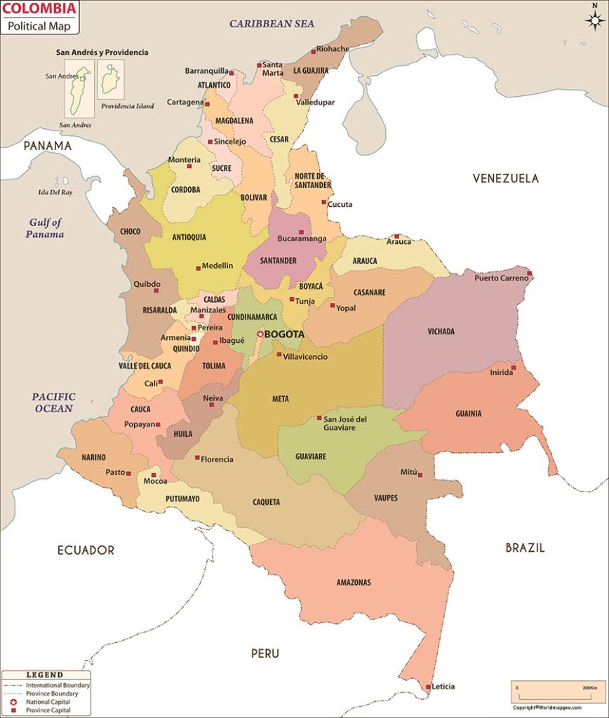
Starting in the north, the Caribbean coast of Colombia is home to some of the most popular tourist destinations in the country. The department of La Guajira is located at the northernmost tip of Colombia and is known for its stunning beaches and unique indigenous culture. The department of Magdalena is home to the city of Santa Marta, which is known for its colonial architecture and proximity to the famous Tayrona National Natural Park. The department of Atlántico is home to Colombia’s fourth largest city, Barranquilla, which is famous for its annual carnival celebrations.
Colombia Labeled Map With Capital
Moving to the west coast of Colombia, we find the department of Chocó. This department is one of the most biodiverse regions in the world and is home to a large Afro-Colombian population. The department is known for its stunning natural beauty, which includes lush rainforests, pristine beaches, and abundant wildlife.
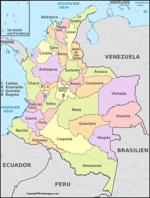
In the southwest of Colombia, we find the department of Nariño. This department is known for its rich cultural heritage, as well as its stunning natural beauty. The city of Pasto, located in Nariño, is home to the famous Black and White Carnival, which takes place in early January every year. The department is also home to several important national parks, including the Galeras Volcano National Park and the Malpelo Fauna and Flora Sanctuary.
Labeled Colombia Map With States
Moving to the central region of Colombia, we find the capital district, Bogota. Bogota is the political, cultural, and economic centre of the country, and is home to over 7 million people. The city is known for its historic centre, which features colonial-era buildings and several important museums, including the Gold Museum and the National Museum of Colombia. The city is also famous for its lively nightlife, which includes salsa dancing and lives music performances.
The department of Cundinamarca surrounds Bogota and is known for its stunning natural beauty. The department is home to several important national parks, including the Chingaza National Natural Park and the Sumapaz Páramo. The department is also home to several important colonial-era towns, including Villa de Leyva and Zipaquirá.
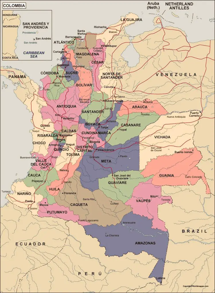
The central region of Colombia is also home to several important coffee-growing regions, including the departments of Caldas, Quindío, and Risaralda. These departments are known for producing some of the best coffee in the world and are popular destinations for tourists who want to learn more about the coffee-making process.
Colombia Map With Cities Labeled
Moving to the east of Colombia, we find the department of Meta. This department is known for its vast plains, which are home to a large cattle ranching industry. The department is also home to several important national parks, including the Sierra de la Macarena National Natural Park.
Finally, in the southeast of Colombia, we find the department of Putumayo. This department is located in the Amazon rainforest and is home to a large indigenous population. The department is known for its rich cultural heritage and stunning natural beauty, which includes lush rainforests, winding rivers, and abundant wildlife.
