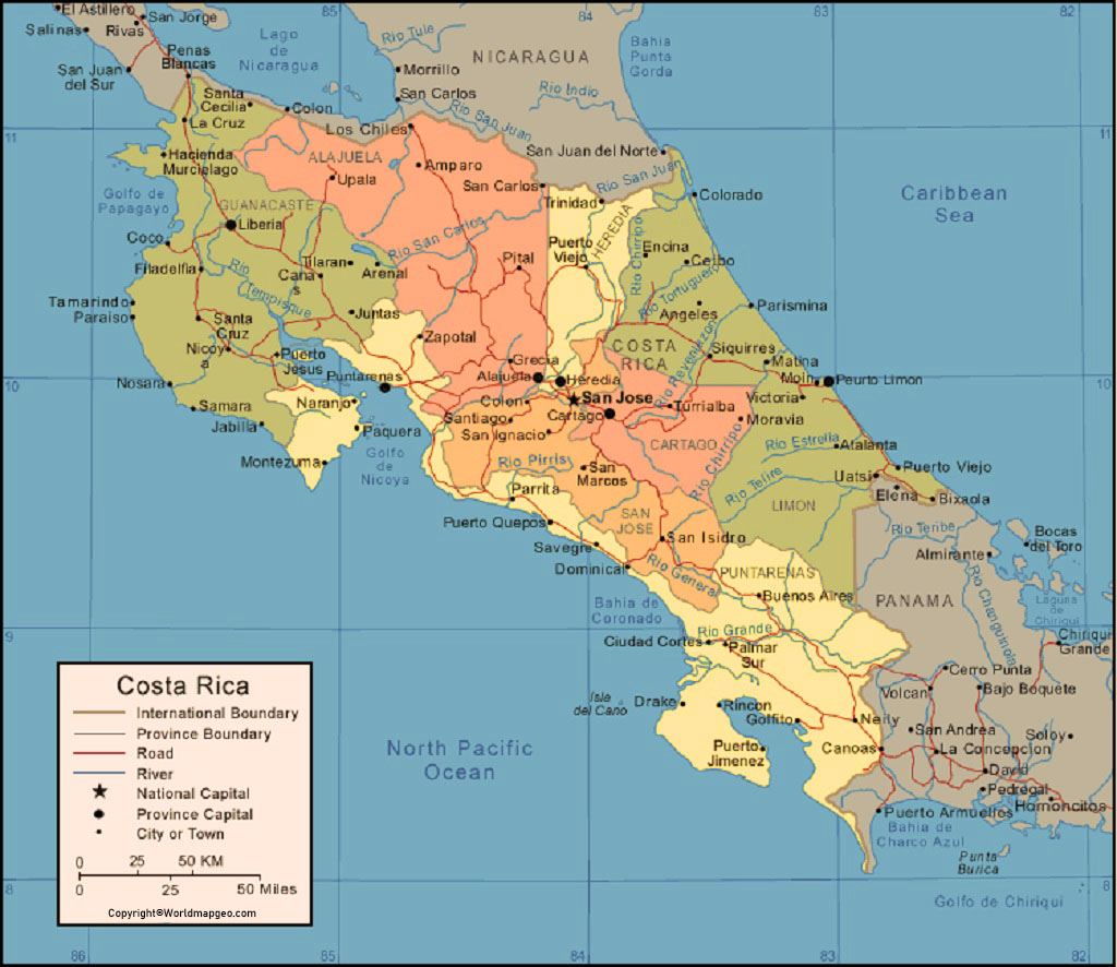
Labeled Costa Rica Map – Costa Rica, officially known as the Republic of Costa Rica, is a small country located in Central America. The country is bordered by Nicaragua to the north, Panama to the southeast, the Pacific Ocean to the west, and the Caribbean Sea to the east. With an area of just over 51,000 square kilometres, Costa Rica is one of the smallest countries in Central America.
Labeled Costa Rica Map
The country is well-known for its diverse landscape, which includes lush rainforests, towering volcanoes, and pristine beaches. It is also home to a wide variety of flora and fauna, making it a popular destination for eco-tourism.
To get a better understanding of the country’s geography and topography, let’s take a look at a labeled map of Costa Rica.
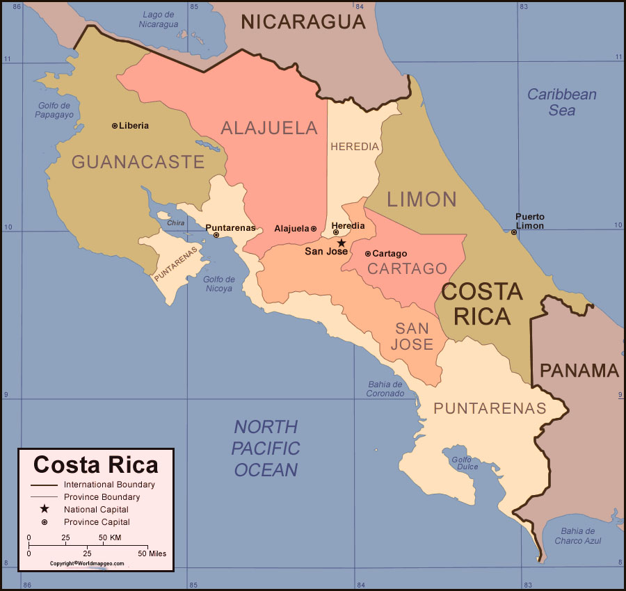
First, let’s take a look at the country’s geography. Costa Rica is divided into seven provinces, each with its own unique culture and characteristics. Starting in the north, the province of Guanacaste borders Nicaragua and is known for its beautiful beaches and dry climate. Moving south, the province of Alajuela is home to the Poas and Arenal volcanoes, as well as the popular tourist destination of La Fortuna.
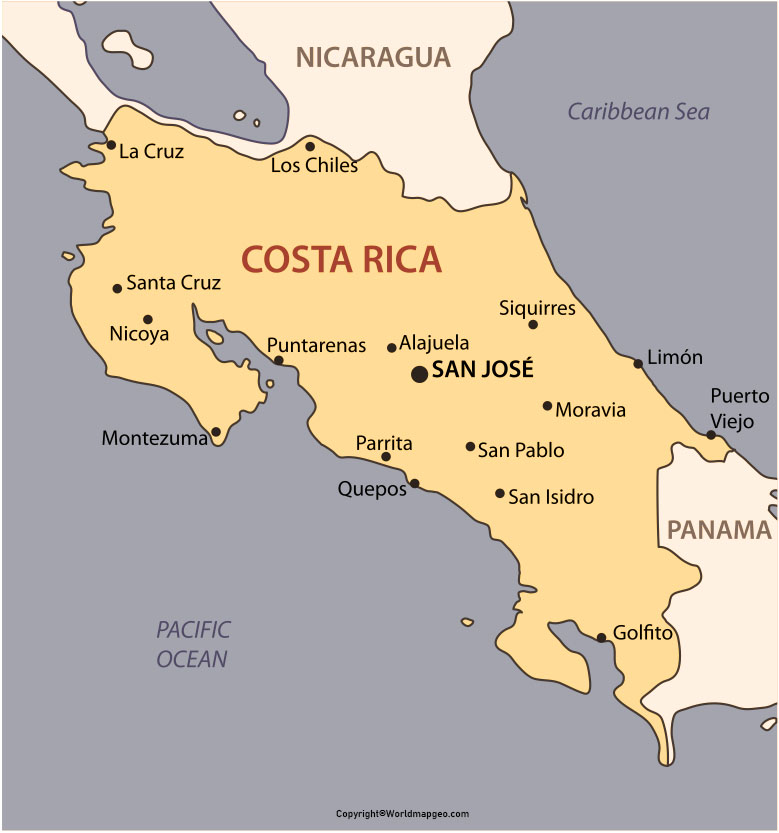
Costa Rica Labeled Map With Capital
Next, we have the province of Heredia, which is known for its coffee plantations and the Braulio Carrillo National Park. San José, the capital city of Costa Rica, is located in the province of San José, which is also home to the famous Irazu volcano. To the south of San José is the province of Cartago, which was the country’s capital before it was moved to San José. Cartago is home to the beautiful Orosi Valley and the Turrialba volcano.
Moving further south, we have the province of Limón, which is located on the Caribbean coast of Costa Rica. Limón is known for its Afro-Caribbean culture and stunning beaches, including the popular tourist destination of Puerto Viejo. Finally, we have the province of Puntarenas, which is located on the Pacific coast and is home to some of the country’s most popular tourist destinations, including Manuel Antonio National Park and the Osa Peninsula.
Labeled Costa Rica Map With States
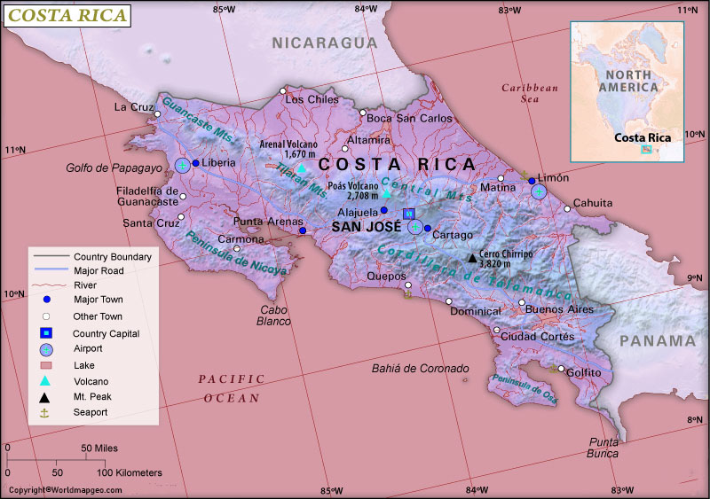
Now that we have a better understanding of the country’s provinces, let’s take a look at some of the major physical features of Costa Rica. One of the most prominent features of the country is the Cordillera Central, a mountain range that runs through the centre of the country. This range is home to several active and inactive volcanoes, including Irazu, Poas, and Arenal.
To the north of the Cordillera Central, we find the Guanacaste Range, a smaller range that runs along the border with Nicaragua. To the east of the Cordillera Central is the Cordillera de Talamanca, a range that runs along the border with Panama. This range is home to Costa Rica’s highest peak, Cerro Chirripó, which stands at 3,820 meters.
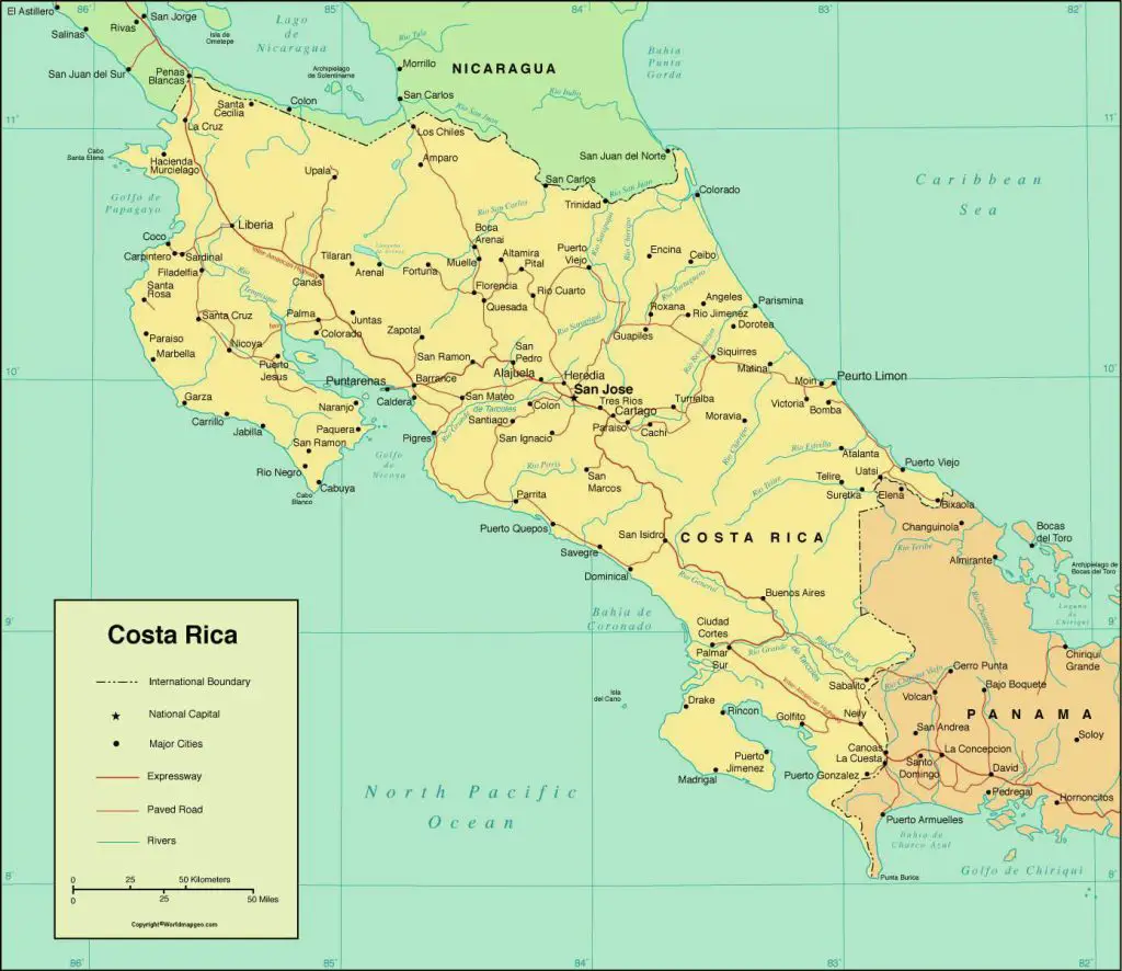
Costa Rica Map With Cities Labeled
In addition to the mountain ranges, Costa Rica is also home to several rivers and lakes. The largest river in the country is the Rio San Juan, which forms part of the border with Nicaragua. Other major rivers include the Rio Tempisque and the Rio Sarapiqui. One of the most famous lakes in Costa Rica is Lake Arenal, which is located near the Arenal volcano and is a popular spot for water sports and fishing.
Now, let’s take a closer look at some of the most popular tourist destinations in Costa Rica. Starting in the north, we have the Nicoya Peninsula, which is known for its stunning beaches and laid-back vibe. The most popular destinations on the peninsula include Tamarindo, Santa Teresa, and Montezuma. Moving south, we have the Arenal area,