A Blank Map of Vietnam is an unlabeled outline map of Vietnam that helps users identify provinces, cities, rivers, neighboring countries, and other geographical features. It is widely used by students, teachers, travelers, researchers, designers, and professionals for geography learning, classroom activities, presentations, and map labeling exercises.
| Feature | Details |
|---|---|
| Country | Vietnam |
| Capital | Hanoi |
| Region | Southeast Asia |
| Continent | Asia |
| Administrative Divisions | 63 Provinces and 5 Centrally Governed Municipalities |
| Available Formats | PDF, PNG, JPG, SVG |
| Printable | Yes |
| Editable | Yes (SVG & AI Vector) |
| Best For | School Projects, Geography Practice, Travel Planning, Presentations |
| License | Free Personal & Educational Use |
On this page, you can download a free printable Blank Vietnam Map in multiple formats, including PDF, PNG, JPG, and SVG. Whether you need a Vietnam outline map for school assignments, a Vietnam province map for administrative studies, or an editable Vietnam SVG map for graphic design projects, you’ll find the right version here.
Our collection includes high-resolution maps that are easy to print on standard paper sizes and suitable for both personal and educational use. Each map is designed with clean boundaries, making it ideal for labeling provinces, marking rivers, identifying major cities, or creating customized geography worksheets.
If you’re looking for a Vietnam map without labels, a printable Vietnam outline map, or a Vietnam map template for presentations and classroom activities, this resource provides everything you need in one place.
Quick Facts About Vietnam
| Feature | Details |
|---|---|
| Official Name | Socialist Republic of Vietnam |
| Capital | Hanoi |
| Largest City | Ho Chi Minh City |
| Continent | Asia |
| Region | Southeast Asia |
| Population | Approximately 101 Million |
| Total Area | 331,212 km² |
| Official Language | Vietnamese |
| Currency | Vietnamese Dong (VND) |
| Time Zone | UTC +7 |
| ISO Code | VN |
| Internet TLD | .vn |
| Calling Code | +84 |
| Neighboring Countries | China, Laos, Cambodia |
| Coastline | Approximately 3,260 km |
| Provinces | 63 |
| Highest Mountain | Fansipan (3,147 m) |
| Longest River | Mekong River |
| National Animal | Water Buffalo |
| National Flower | Lotus |
What Is a Blank Map of Vietnam?
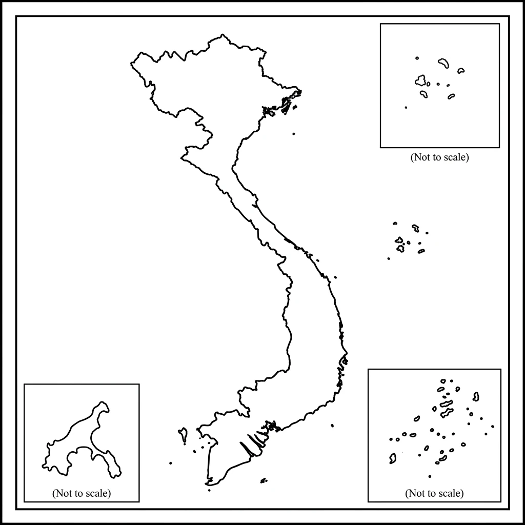
A Blank Vietnam Map is a simplified map that displays the outline of Vietnam without labels, names, or additional geographic information. Depending on the version, it may show only the national boundary or include provincial boundaries, major rivers, coastlines, and islands while leaving all locations unlabeled for users to identify themselves.
Unlike a Political Map of Vietnam, which includes province names, capitals, and administrative boundaries, or a Physical Map of Vietnam, which highlights mountains, rivers, and elevation, a blank map focuses on providing a clean base for learning, planning, and customization.
Because of its flexibility, a blank map is one of the most commonly used educational resources for geography practice. Teachers often use it for classroom quizzes, while students rely on it to memorize provinces, label important cities, and understand Vietnam’s physical and political geography.
Professionals also use editable Vietnam outline maps to create business presentations, logistics plans, research reports, and travel guides. Graphic designers frequently prefer Vietnam SVG maps because they can be resized and edited without losing quality.
Difference Between Blank, Political, and Physical Maps
| Map Type | Purpose | Includes Labels |
|---|---|---|
| Blank Vietnam Map | Practice, labeling, customization | No |
| Political Vietnam Map | Provinces, cities, borders | Yes |
| Physical Vietnam Map | Mountains, rivers, terrain | Yes |
| Road Map | Highways and roads | Yes |
| Tourist Map | Tourist attractions | Yes |
| Administrative Map | Provincial boundaries | Yes |
Features of Our Blank Map of Vietnam
Our Printable Blank Vietnam Map is designed for accuracy, clarity, and ease of use. Whether you’re preparing a geography assignment or creating a presentation, these maps provide a professional-quality foundation.
Key Features
- High-resolution printable maps
- Clean and accurate country outline
- Clearly defined provincial boundaries (selected versions)
- Free download without registration
- Available in PDF, PNG, JPG, and SVG formats
- Easy to edit for presentations and graphic design
- Suitable for classrooms and educational activities
- Ideal for geography worksheets and quizzes
- Perfect for coloring projects
- Compatible with A4, A3, Letter, and poster-size printing
- Optimized for both digital and printed use
- Regularly updated to reflect current administrative boundaries
These features make our Vietnam map printable collection suitable for students, teachers, researchers, travel planners, businesses, and map enthusiasts.
Types of Blank Vietnam Maps
Different users have different requirements. That’s why we provide multiple versions of the Blank Vietnam Map, each designed for a specific purpose.
1. Simple Outline Map of Vietnam
The Vietnam Outline Map displays only the country’s external boundary without labels or internal details. It is ideal for beginners who want to practice identifying Vietnam’s location and shape.
Best Uses
- School assignments
- Geography practice
- Drawing exercises
- Classroom quizzes
- Coloring activities
- Basic map labeling
2. Blank Vietnam Provinces Map
This version includes provincial boundaries while leaving province names blank. It allows students to practice identifying all provinces and centrally governed municipalities.
Best Uses
- Province identification
- Administrative geography
- Competitive exam preparation
- School worksheets
- Province labeling practice
3. Blank Political Map of Vietnam
The blank political map outlines administrative divisions without names. It helps users understand Vietnam’s political geography while allowing room for manual labeling.
Best Uses
- Political geography lessons
- Province mapping
- Administrative studies
- Government training materials
4. Blank Physical Map of Vietnam
This version focuses on Vietnam’s natural landscape by showing mountains, rivers, and major physical regions without labels.
Best Uses
- Geography classes
- Physical feature identification
- River labeling
- Mountain practice
- Environmental studies
5. Blank River Map of Vietnam
The Vietnam River Map highlights major river systems such as the Mekong River and Red River while keeping labels removed for educational purposes.
Best Uses
- Hydrology lessons
- River identification
- Geography quizzes
- School projects
6. Blank Road Map of Vietnam
The blank road map displays the country’s transportation network without road names, making it useful for logistics planning and route exercises.
Best Uses
- Transportation studies
- Route planning
- Logistics presentations
- Travel planning
7. Blank Administrative Map of Vietnam
This map focuses on administrative divisions and province boundaries without names, making it suitable for official planning and educational use.
Best Uses
- Administrative planning
- Government projects
- GIS mapping
- Province studies
8. Blank Vietnam Map with Neighboring Countries
This map displays Vietnam along with surrounding countries, allowing users to study regional geography.
Best Uses
- Southeast Asia geography
- Border studies
- International relations
- Regional planning
9. Blank Vietnam Map with Islands
This version includes major islands and island groups surrounding Vietnam without labels.
Best Uses
- Island identification
- Maritime geography
- School assignments
- Geography projects
10. Blank Vietnam Map for Kids
Designed with simplicity in mind, this version uses bold outlines and minimal details, making it easier for children to color, label, and learn.
Best Uses
- Elementary classrooms
- Homeschooling
- Coloring activities
- Geography games
- Educational worksheets
Vietnam Political Geography
Vietnam is a unitary socialist republic located in Southeast Asia on the eastern coast of the Indochinese Peninsula. The country stretches over 1,650 kilometers (1,025 miles) from north to south, giving it a long, narrow shape along the South China Sea. Vietnam shares international borders with China to the north, Laos to the west, and Cambodia to the southwest.
Administratively, Vietnam is divided into 63 provinces and 5 centrally governed municipalities. These administrative divisions play a vital role in governance, economic development, education, transportation, and regional planning. On a Blank Vietnam Map, labeling these provinces and municipalities is an excellent way to improve geographical knowledge and understand the country’s administrative structure.
For educational purposes, Vietnam is commonly grouped into three major regions—Northern Vietnam, Central Vietnam, and Southern Vietnam. These are further divided into eight geographical regions, each with its own physical landscape, economy, and cultural identity.
Administrative Regions of Vietnam
Vietnam is commonly divided into the following geographical regions:
| Region | Description |
|---|---|
| Northeast | A mountainous region bordering China with rich mineral resources and scenic landscapes. |
| Northwest | Home to Vietnam’s highest mountains, ethnic minority communities, and terraced rice fields. |
| Red River Delta | One of the country’s most densely populated and economically important regions, including Hanoi. |
| North Central Coast | Known for its historical cities, beaches, and national parks. |
| South Central Coast | Famous for coastal tourism, fishing, and growing urban centers. |
| Central Highlands | Coffee-producing region with forests, waterfalls, and volcanic plateaus. |
| Southeast | Vietnam’s industrial and commercial hub, including Ho Chi Minh City. |
| Mekong River Delta | The agricultural heartland, known for rice production, canals, and floating markets. |
These regions are frequently used in geography textbooks, travel guides, economic reports, and government planning.
Complete List of Vietnam Provinces
Vietnam currently has 63 first-level administrative divisions, including provinces and centrally governed municipalities. The table below lists the provinces, their capitals, and their geographical regions.
| Province | Capital | Region |
|---|---|---|
| An Giang | Long Xuyen | Mekong Delta |
| Ba Ria–Vung Tau | Vung Tau | Southeast |
| Bac Giang | Bac Giang | Northeast |
| Bac Kan | Bac Kan | Northeast |
| Bac Lieu | Bac Lieu | Mekong Delta |
| Bac Ninh | Bac Ninh | Red River Delta |
| Ben Tre | Ben Tre | Mekong Delta |
| Binh Dinh | Quy Nhon | South Central Coast |
| Binh Duong | Thu Dau Mot | Southeast |
| Binh Phuoc | Dong Xoai | Southeast |
| Binh Thuan | Phan Thiet | South Central Coast |
| Ca Mau | Ca Mau | Mekong Delta |
| Cao Bang | Cao Bang | Northeast |
| Dak Lak | Buon Ma Thuot | Central Highlands |
| Dak Nong | Gia Nghia | Central Highlands |
| Dien Bien | Dien Bien Phu | Northwest |
| Dong Nai | Bien Hoa | Southeast |
| Dong Thap | Cao Lanh | Mekong Delta |
| Gia Lai | Pleiku | Central Highlands |
| Ha Giang | Ha Giang | Northeast |
| Ha Nam | Phu Ly | Red River Delta |
| Ha Tinh | Ha Tinh | North Central Coast |
| Hai Duong | Hai Duong | Red River Delta |
| Hau Giang | Vi Thanh | Mekong Delta |
| Hoa Binh | Hoa Binh | Northwest |
| Hung Yen | Hung Yen | Red River Delta |
| Khanh Hoa | Nha Trang | South Central Coast |
| Kien Giang | Rach Gia | Mekong Delta |
| Kon Tum | Kon Tum | Central Highlands |
| Lai Chau | Lai Chau | Northwest |
| Lam Dong | Da Lat | Central Highlands |
| Lang Son | Lang Son | Northeast |
| Lao Cai | Lao Cai | Northwest |
| Long An | Tan An | Mekong Delta |
| Nam Dinh | Nam Dinh | Red River Delta |
| Nghe An | Vinh | North Central Coast |
| Ninh Binh | Ninh Binh | Red River Delta |
| Ninh Thuan | Phan Rang–Thap Cham | South Central Coast |
| Phu Tho | Viet Tri | Northeast |
| Phu Yen | Tuy Hoa | South Central Coast |
| Quang Binh | Dong Hoi | North Central Coast |
| Quang Nam | Tam Ky | South Central Coast |
| Quang Ngai | Quang Ngai | South Central Coast |
| Quang Ninh | Ha Long | Northeast |
| Quang Tri | Dong Ha | North Central Coast |
| Soc Trang | Soc Trang | Mekong Delta |
| Son La | Son La | Northwest |
| Tay Ninh | Tay Ninh | Southeast |
| Thai Binh | Thai Binh | Red River Delta |
| Thai Nguyen | Thai Nguyen | Northeast |
| Thanh Hoa | Thanh Hoa | North Central Coast |
| Thua Thien Hue | Hue | North Central Coast |
| Tien Giang | My Tho | Mekong Delta |
| Tra Vinh | Tra Vinh | Mekong Delta |
| Tuyen Quang | Tuyen Quang | Northeast |
| Vinh Long | Vinh Long | Mekong Delta |
| Vinh Phuc | Vinh Yen | Red River Delta |
| Yen Bai | Yen Bai | Northwest |
Note: Vietnam’s administrative boundaries can change through government reforms. Always ensure your downloadable maps reflect the latest official administrative divisions.
Centrally Governed Municipalities
In addition to its provinces, Vietnam has five centrally governed municipalities that have the same administrative level as provinces. These cities are major political, economic, industrial, and cultural centers.
| Municipality | Region | Importance |
|---|---|---|
| Hanoi | Red River Delta | Capital of Vietnam and the political center |
| Ho Chi Minh City | Southeast | Largest city and economic hub |
| Da Nang | South Central Coast | Major port city and tourism center |
| Hai Phong | Red River Delta | Largest seaport in northern Vietnam |
| Can Tho | Mekong Delta | Largest city in the Mekong Delta region |
These municipalities are often highlighted separately on Vietnam administrative maps because of their strategic importance.
Major Cities to Label on a Blank Map of Vietnam
Learning the locations of Vietnam’s major cities helps students and travelers understand the country’s geography, transportation network, and regional development. These cities are commonly marked on Vietnam political maps, educational worksheets, and classroom maps.
| City | Province / Municipality | Approx. Population | Why It Is Famous |
|---|---|---|---|
| Hanoi | Hanoi | 8+ million | National capital, government, culture |
| Ho Chi Minh City | Ho Chi Minh City | 9+ million | Largest city, finance, business |
| Da Nang | Da Nang | 1.2+ million | Beaches, international airport, tourism |
| Hue | Thua Thien Hue | 650,000+ | Imperial City, UNESCO heritage |
| Hoi An | Quang Nam | 120,000+ | Ancient Town, tourism |
| Can Tho | Can Tho | 1.3+ million | Floating markets, Mekong Delta |
| Hai Phong | Hai Phong | 2+ million | Major seaport and industry |
| Nha Trang | Khanh Hoa | 500,000+ | Beaches and diving destination |
| Da Lat | Lam Dong | 250,000+ | Mountain resort city |
| Vung Tau | Ba Ria–Vung Tau | 500,000+ | Coastal tourism and oil industry |
| Ha Long | Quang Ninh | 300,000+ | Gateway to Ha Long Bay |
| Sapa | Lao Cai | 40,000+ | Mountain trekking and rice terraces |
| Quy Nhon | Binh Dinh | 300,000+ | Coastal city and fishing port |
| Phan Thiet | Binh Thuan | 335,000+ | Beaches and Mui Ne dunes |
| Buon Ma Thuot | Dak Lak | 420,000+ | Vietnam’s coffee capital |
Tips for Labeling Cities on a Blank Map of Vietnam
When practicing with a printable Blank Vietnam Map, try labeling the following in order:
- Hanoi is in the north.
- Hai Phong is near the Gulf of Tonkin.
- Ha Long is along the northeastern coast.
- Hue and Da Nang in Central Vietnam.
- Hoi An is just south of Da Nang.
- Quy Nhon, Nha Trang, and Phan Thiet along the south-central coastline.
- Buon Ma Thuot and Da Lat in the Central Highlands.
- Ho Chi Minh City in the southeast.
- Can Tho in the Mekong Delta.
- Vung Tau is on the southeastern coast.
Marking these cities helps improve map-reading skills and provides a better understanding of Vietnam’s geography, economy, and transportation network.
Neighboring Countries of Vietnam
Vietnam is strategically located in Southeast Asia and shares land borders with three countries. Understanding these neighboring nations is important for geography studies, travel planning, and map labeling exercises. On a Blank Vietnam Map, marking the international borders helps students and learners understand Vietnam’s location within the region.
| Country | Direction | Approx. Border Length | Major Border Crossing |
|---|---|---|---|
| China | North | 1,449 km | Huu Nghi–Youyi Guan |
| Laos | West | 2,161 km | Lao Bao Border Gate |
| Cambodia | Southwest | 1,137 km | Moc Bai Border Gate |
Why Label Neighboring Countries?
Adding neighboring countries to a Vietnam outline map helps users:
- Understand Vietnam’s international boundaries.
- Learn Southeast Asian geography.
- Practice border identification.
- Improve map-labeling skills for school projects and competitive exams.
- Create informative classroom worksheets and presentations.
Vietnam Coastline
Vietnam has one of the longest coastlines in Southeast Asia, stretching approximately 3,260 kilometers (2,026 miles). The coastline extends from the Gulf of Tonkin in the north to the Gulf of Thailand in the southwest, making it an important center for trade, fishing, tourism, and maritime transportation.
When using a Blank Vietnam Map, students can trace the coastline and identify major bays, beaches, ports, and coastal cities.
Major Coastal Water Bodies
| Water Body | Location | Importance |
|---|---|---|
| South China Sea | East of Vietnam | Main maritime boundary, shipping routes, and fisheries |
| Gulf of Tonkin | Northeast | Shared with China, major ports, and fishing |
| Gulf of Thailand | Southwest | Tourism, coastal trade, and marine biodiversity |
Major Coastal Cities to Label
- Hai Phong
- Ha Long
- Da Nang
- Hoi An
- Quy Nhon
- Nha Trang
- Phan Thiet
- Vung Tau
Major Rivers of Vietnam
Vietnam’s rivers support agriculture, transportation, fisheries, and hydroelectric power. They also shape many of the country’s fertile plains and deltas. Labeling these rivers on a Vietnam river map helps students understand the country’s physical geography.
| River | Approx. Length | Region | Importance |
|---|---|---|---|
| Mekong River | 4,350 km (total) | Southern Vietnam | Agriculture, fisheries, Mekong Delta |
| Red River (Hong River) | 1,149 km | Northern Vietnam | Irrigation, transportation, Red River Delta |
| Dong Nai River | 586 km | Southeast | Water supply and hydroelectric power |
| Perfume River | 80 km | Central Vietnam | Flows through Hue, tourism |
| Ma River | 512 km | North Central | Agriculture and irrigation |
| Thu Bon River | 205 km | Central Vietnam | Supports the Hoi An region |
| Ca River | 531 km | North Central | Farming and local transportation |
Rivers to Mark on Your Blank Vietnam Map
For geography practice, label:
- Mekong River
- Red River
- Dong Nai River
- Perfume River
- Ma River
- Thu Bon River
- Ca River
These rivers are commonly included in Vietnam geography maps, school worksheets, and physical maps.
Mountains and Highlands
Although Vietnam is famous for its coastline, nearly three-quarters of the country consists of hills and mountains. These mountain ranges influence the climate, biodiversity, and river systems across the country.
| Mountain / Highland | Elevation | Location | Importance |
|---|---|---|---|
| Fansipan | 3,147 m | Lao Cai Province | The highest mountain in Vietnam |
| Annamite Range | — | Along the Laos border | Major mountain system |
| Hoang Lien Son Range | — | Northwest | Home to Fansipan |
| Central Highlands | Plateau Region | Central Vietnam | Coffee production and forests |
Features to Label
- Fansipan
- Hoang Lien Son Mountains
- Annamite Range
- Central Highlands
Adding these physical features to a Blank Vietnam Physical Map helps learners understand elevation patterns and regional geography.
Islands of Vietnam
Vietnam has thousands of islands and islets, many of which are known for tourism, biodiversity, and strategic importance. Including these islands on a Vietnam outline map provides a more complete picture of the country’s geography.
| Island / Island Group | Location | Known For |
|---|---|---|
| Phu Quoc | Gulf of Thailand | Beaches, tourism, and a national park |
| Cat Ba Island | Hai Phong | Cat Ba National Park |
| Con Dao Islands | Southern Vietnam | Marine life, historical sites |
| Ly Son Island | Quang Ngai | Volcanic landscapes |
| Cham Islands | Near Hoi An | Coral reefs and marine reserves |
| Spratly Islands | South China Sea | Strategic importance |
| Paracel Islands | South China Sea | Strategic importance |
Why Label Vietnam’s Islands?
Students and travelers often use a Blank Vietnam Map with Islands to:
- Learn island locations.
- Understand maritime geography.
- Study protected marine ecosystems.
- Explore major tourist destinations.
National Parks of Vietnam
Vietnam is home to many protected national parks that preserve forests, wildlife, caves, wetlands, and rare species. These parks are important for environmental education and ecotourism.
| National Park | Province | Famous For |
|---|---|---|
| Phong Nha–Ke Bang | Quang Binh | Limestone caves and karst landscapes |
| Cat Tien | Dong Nai | Tropical rainforest and wildlife |
| Cuc Phuong | Ninh Binh | Vietnam’s oldest national park |
| Ba Be | Bac Kan | Freshwater lake and forests |
| Bach Ma | Thua Thien Hue | Mountains and waterfalls |
| Yok Don | Dak Lak | Dry deciduous forest |
| Con Dao | Ba Ria–Vung Tau | Marine biodiversity and sea turtles |
Educational Uses
These parks are excellent locations to mark on a Vietnam educational map for:
- Environmental studies
- Biodiversity projects
- Conservation lessons
- Tourism research
UNESCO World Heritage Sites in Vietnam
Vietnam is home to several UNESCO World Heritage Sites that highlight its natural beauty, history, and cultural heritage. Labeling these locations on a Blank Vietnam Map helps students connect geography with history and culture.
| UNESCO Site | Province | Category |
|---|---|---|
| Ha Long Bay | Quang Ninh | Natural |
| Hoi An Ancient Town | Quang Nam | Cultural |
| Complex of Hue Monuments | Thua Thien Hue | Cultural |
| Phong Nha–Ke Bang National Park | Quang Binh | Natural |
| My Son Sanctuary | Quang Nam | Cultural |
| Trang An Landscape Complex | Ninh Binh | Mixed |
| Thang Long Imperial Citadel | Hanoi | Cultural |
Why Include UNESCO Sites on a Blank Map of Vietnam?
Marking these locations helps users:
- Learn Vietnam’s cultural and natural heritage.
- Improve geography and history knowledge.
- Prepare for school projects and presentations.
- Plan educational and tourism-related activities.
Quick Geography Practice Checklist
Use your Printable Blank Vietnam Map and try labeling the following:
- Hanoi
- Ho Chi Minh City
- Da Nang
- China, Laos, and Cambodia
- South China Sea
- Gulf of Tonkin
- Gulf of Thailand
- Mekong River
- Red River
- Fansipan
- Central Highlands
- Phu Quoc Island
- Ha Long Bay
- Phong Nha–Ke Bang National Park
Completing this exercise is a practical way to reinforce knowledge of Vietnam’s political and physical geography while making the map more engaging for students and educators.
Airports to Mark on a Blank Map of Vietnam
Vietnam has a well-developed aviation network that connects major cities, tourist destinations, and business centers. Marking airports on a Blank Vietnam Map helps students understand transportation geography while assisting travelers in planning domestic and international trips.
Whether you’re using a Vietnam outline map for classroom activities or preparing a travel itinerary, these airports are among the most important to identify.
| Airport | City | Region | Importance |
|---|---|---|---|
| Noi Bai International Airport (HAN) | Hanoi | Northern Vietnam | Main international gateway to the capital |
| Tan Son Nhat International Airport (SGN) | Ho Chi Minh City | Southern Vietnam | Vietnam’s busiest airport |
| Da Nang International Airport (DAD) | Da Nang | Central Vietnam | Serves central coastal destinations |
| Cam Ranh International Airport (CXR) | Nha Trang | South Central Coast | Gateway to beach resorts |
| Phu Quoc International Airport (PQC) | Phu Quoc | Gulf of Thailand | Tourism and island travel |
| Can Tho International Airport (VCA) | Can Tho | Mekong Delta | Regional transportation hub |
Airports to Label
When practicing with a Printable Blank Map of Vietnam, label:
- Noi Bai International Airport
- Tan Son Nhat International Airport
- Da Nang International Airport
- Cam Ranh International Airport
- Phu Quoc International Airport
- Can Tho International Airport
These airports are commonly shown on Vietnam transportation maps and travel planning maps.
Tourist Attractions to Mark
Vietnam offers a remarkable mix of natural landscapes, historic cities, cultural landmarks, and beautiful coastlines. Marking famous tourist attractions on a Blank Vietnam Map is a great way to learn the country’s geography while planning future trips.
| Tourist Attraction | Province / City | Why Visit |
|---|---|---|
| Ha Long Bay | Quang Ninh | Limestone islands and cruises |
| Hoi An Ancient Town | Quang Nam | Historic architecture and lantern streets |
| Hanoi Old Quarter | Hanoi | Traditional markets and cultural heritage |
| Mekong Delta | Southern Vietnam | Floating markets and river life |
| Sapa | Lao Cai | Rice terraces and mountain trekking |
| Da Nang | Da Nang | Beaches and modern attractions |
| Hue Imperial City | Thua Thien Hue | Historic royal monuments |
| Ninh Binh | Ninh Binh | Limestone landscapes and boat tours |
| Ba Na Hills | Da Nang | Cable car and Golden Bridge |
| Phu Quoc Island | Kien Giang | Tropical beaches and diving |
| Marble Mountains | Da Nang | Caves, temples, and panoramic views |
| Golden Bridge | Da Nang | Iconic pedestrian bridge |
Why Label Tourist Attractions?
Adding famous destinations to a Vietnam travel map helps users:
- Understand the country’s tourism geography.
- Plan travel routes.
- Learn where famous landmarks are located.
- Improve geography knowledge through real-world examples.
Educational Uses of a Blank Map of Vietnam
A Blank Vietnam Map is one of the most useful educational resources for learning about Southeast Asia. Teachers and students use outline maps in classrooms because they encourage active learning rather than simple memorization.
Common Educational Uses
1. School Projects
Students can label provinces, major cities, rivers, mountain ranges, and neighboring countries to complete geography assignments.
2. Geography Practice
Outline maps help learners identify Vietnam’s physical and political features without relying on pre-labeled maps.
3. Classroom Quizzes
Teachers frequently distribute Vietnam worksheet maps during geography lessons to test students’ map-reading skills.
4. Homework Assignments
Printable maps provide an easy way for students to practice labeling administrative divisions at home.
5. Map Labeling Exercises
Students can identify:
- Provinces
- Capitals
- Rivers
- Mountains
- Islands
- National Parks
- UNESCO Sites
6. History Lessons
Blank maps are useful for explaining historical events, trade routes, and regional development across Vietnam.
7. Environmental Studies
Students can mark forests, rivers, national parks, wetlands, and protected areas to better understand Vietnam’s diverse ecosystems.
8. Competitive Exam Preparation
Many geography and civil service examinations require candidates to identify locations on blank maps, making regular practice highly beneficial.
Vietnam Population Map – Vietnam Population of Men, Women, Children
| Province & Municipality | Population | Men Population | Women Population | Children (0-14) | % of Total Population |
|---|---|---|---|---|---|
| An Giang | 1,908,000 | 940,000 | 968,000 | 400,680 | 1.9 |
| Bà Rịa-Vũng Tàu | 1,185,000 | 590,000 | 595,000 | 248,850 | 1.2 |
| Bà Rịa–Vũng Tàu | 1,195,000 | 598,000 | 597,000 | 251,000 | 1.2 |
| Bình Dương | 2,750,000 | 1,350,000 | 1,400,000 | 577,500 | 2.8 |
| Bình Phước | 1,045,000 | 530,000 | 515,000 | 219,450 | 1.1 |
| Bình Thuận | 1,250,000 | 620,000 | 630,000 | 262,500 | 1.3 |
| Bình Định | 1,520,000 | 750,000 | 770,000 | 319,200 | 1.5 |
| Bạc Liêu | 920,000 | 455,000 | 465,000 | 193,200 | 0.9 |
| Bắc Giang | 1,895,000 | 945,000 | 950,000 | 397,950 | 1.9 |
| Bắc Kạn | 323,000 | 163,000 | 160,000 | 67,830 | 0.3 |
| Bắc Ninh | 1,470,000 | 720,000 | 750,000 | 308,700 | 1.5 |
| Bến Tre | 1,295,000 | 635,000 | 660,000 | 271,950 | 1.3 |
| Cao Bằng | 540,000 | 270,000 | 270,000 | 113,400 | 0.5 |
| Cà Mau | 1,210,000 | 600,000 | 610,000 | 254,100 | 1.2 |
| Cần Thơ | 1,280,000 | 625,000 | 655,000 | 268,800 | 1.3 |
| Gia Lai | 1,560,000 | 790,000 | 770,000 | 327,600 | 1.6 |
| Hà Giang | 895,000 | 450,000 | 445,000 | 187,950 | 0.9 |
| Hà Nam | 860,000 | 420,000 | 440,000 | 180,600 | 0.9 |
| Hà Nội | 8,590,000 | 4,200,000 | 4,390,000 | 1,803,900 | 8.6 |
| Hà Tĩnh | 1,290,000 | 635,000 | 655,000 | 270,900 | 1.3 |
| Hòa Bình | 870,000 | 435,000 | 435,000 | 182,700 | 0.9 |
| Hưng Yên | 1,290,000 | 630,000 | 660,000 | 270,900 | 1.3 |
| Hải Dương | 1,950,000 | 960,000 | 990,000 | 409,500 | 2 |
| Hải Phòng | 2,100,000 | 1,030,000 | 1,070,000 | 441,000 | 2.1 |
| Hậu Giang | 780,000 | 385,000 | 395,000 | 163,800 | 0.8 |
| Hồ Chí Minh | 9,500,000 | 4,608,000 | 4,892,000 | 1,710,000 | 9.5 |
| Hồ Chí Minh City | 9,550,000 | 4,650,000 | 4,900,000 | 2,005,500 | 9.6 |
| Khánh Hòa | 1,260,000 | 625,000 | 635,000 | 264,600 | 1.3 |
| Kiên Giang | 1,780,000 | 890,000 | 890,000 | 373,800 | 1.8 |
| Kon Tum | 580,000 | 295,000 | 285,000 | 121,800 | 0.6 |
| Lai Châu | 490,000 | 250,000 | 240,000 | 102,900 | 0.5 |
| Long An | 1,750,000 | 865,000 | 885,000 | 367,500 | 1.8 |
| Lào Cai | 760,000 | 385,000 | 375,000 | 159,600 | 0.8 |
| Lâm Đồng | 1,340,000 | 675,000 | 665,000 | 281,400 | 1.3 |
| Lạng Sơn | 810,000 | 405,000 | 405,000 | 170,100 | 0.8 |
| Nam Định | 1,870,000 | 915,000 | 955,000 | 392,700 | 1.9 |
| Nghệ An | 3,400,000 | 1,680,000 | 1,720,000 | 714,000 | 3.4 |
| Ninh Bình | 1,010,000 | 495,000 | 515,000 | 212,100 | 1 |
| Ninh Thuận | 620,000 | 310,000 | 310,000 | 130,200 | 0.6 |
| Phú Thọ | 1,490,000 | 735,000 | 755,000 | 312,900 | 1.5 |
| Phú Yên | 920,000 | 455,000 | 465,000 | 193,200 | 0.9 |
| Quảng Bình | 920,000 | 455,000 | 465,000 | 193,200 | 0.9 |
| Quảng Nam | 1,520,000 | 755,000 | 765,000 | 319,200 | 1.5 |
| Quảng Ngãi | 1,270,000 | 630,000 | 640,000 | 266,700 | 1.3 |
| Quảng Ninh | 1,380,000 | 690,000 | 690,000 | 289,800 | 1.4 |
| Quảng Trị | 650,000 | 320,000 | 330,000 | 136,500 | 0.7 |
| Sóc Trăng | 1,210,000 | 600,000 | 610,000 | 254,100 | 1.2 |
| Sơn La | 1,280,000 | 645,000 | 635,000 | 268,800 | 1.3 |
| Thanh Hóa | 3,690,000 | 1,820,000 | 1,870,000 | 774,900 | 3.7 |
| Thái Bình | 1,870,000 | 920,000 | 950,000 | 392,700 | 1.9 |
| Thái Nguyên | 1,380,000 | 685,000 | 695,000 | 289,800 | 1.4 |
| Thừa Thiên Huế | 1,180,000 | 580,000 | 600,000 | 247,800 | 1.2 |
| Tiền Giang | 1,780,000 | 875,000 | 905,000 | 373,800 | 1.8 |
| Trà Vinh | 1,050,000 | 520,000 | 530,000 | 220,500 | 1.1 |
| Tuyên Quang | 810,000 | 405,000 | 405,000 | 170,100 | 0.8 |
| Tây Ninh | 1,210,000 | 600,000 | 610,000 | 254,100 | 1.2 |
| Vĩnh Long | 1,050,000 | 515,000 | 535,000 | 220,500 | 1.1 |
| Vĩnh Phúc | 1,200,000 | 590,000 | 610,000 | 252,000 | 1.2 |
| Yên Bái | 850,000 | 425,000 | 425,000 | 178,500 | 0.9 |
| Điện Biên | 620,000 | 315,000 | 305,000 | 130,200 | 0.6 |
| Đà Nẵng | 1,220,000 | 600,000 | 620,000 | 256,200 | 1.2 |
| Đắk Lắk | 1,920,000 | 970,000 | 950,000 | 403,200 | 1.9 |
| Đắk Nông | 690,000 | 355,000 | 335,000 | 144,900 | 0.7 |
| Đồng Nai | 3,250,000 | 1,600,000 | 1,650,000 | 682,500 | 3.3 |
| Đồng Tháp | 1,690,000 | 835,000 | 855,000 | 354,900 | 1.7 |
| TOTAL | 99,500,000 | 49,010,000 | 50,490,000 | 20,895,000 | 100 |
Geographical Vietnam Map – Vietnam Area Ranking in the World
Vietnam ranks 66th in the world, area-wise.
| Province & Municipality | Capital | Area (sq km) | % of Total Area |
|---|---|---|---|
| An Giang | Long Xuyên | 3,536 | 1.07 |
| Bà Rịa–Vũng Tàu | Vũng Tàu | 1,989 | 0.6 |
| Bình Dương | Thủ Dầu Một | 2,694 | 0.81 |
| Bình Phước | Đồng Xoài | 6,871 | 2.08 |
| Bình Thuận | Phan Thiết | 7,813 | 2.36 |
| Bình Định | Quy Nhơn | 6,025 | 1.82 |
| Bạc Liêu | Bạc Liêu | 2,584 | 0.78 |
| Bắc Giang | Bắc Giang | 3,895 | 1.18 |
| Bắc Kạn | Bắc Kạn | 4,859 | 1.47 |
| Bắc Ninh | Bắc Ninh | 823 | 0.25 |
| Bến Tre | Bến Tre | 2,360 | 0.71 |
| Cao Bằng | Cao Bằng | 6,700 | 2.02 |
| Cà Mau | Cà Mau | 5,294 | 1.6 |
| Cần Thơ | Cần Thơ | 1,401 | 0.42 |
| Gia Lai | Pleiku | 15,537 | 4.69 |
| Hà Giang | Hà Giang | 7,945 | 2.4 |
| Hà Nam | Phủ Lý | 860 | 0.26 |
| Hà Nội | Hà Nội | 3,359 | 1.01 |
| Hà Tĩnh | Hà Tĩnh | 5,997 | 1.81 |
| Hòa Bình | Hòa Bình | 4,608 | 1.39 |
| Hưng Yên | Hưng Yên | 926 | 0.28 |
| Hải Dương | Hải Dương | 1,668 | 0.5 |
| Hải Phòng | Hải Phòng | 1,562 | 0.47 |
| Hậu Giang | Vị Thanh | 1,621 | 0.49 |
| Hồ Chí Minh | Hồ Chí Minh City | 2,061 | 0.62 |
| Hồ Chí Minh City | Hồ Chí Minh City | 2,096 | 0.63 |
| Khánh Hòa | Nha Trang | 5,218 | 1.58 |
| Kiên Giang | Rạch Giá | 6,346 | 1.92 |
| Kon Tum | Kon Tum | 9,690 | 2.93 |
| Lai Châu | Lai Châu | 9,068 | 2.74 |
| Long An | Tân An | 4,493 | 1.36 |
| Lào Cai | Lào Cai | 6,364 | 1.92 |
| Lâm Đồng | Đà Lạt | 9,783 | 2.96 |
| Lạng Sơn | Lạng Sơn | 8,320 | 2.51 |
| Nam Định | Nam Định | 1,652 | 0.5 |
| Nghệ An | Vinh | 16,490 | 4.98 |
| Ninh Bình | Ninh Bình | 1,378 | 0.42 |
| Ninh Thuận | Phan Rang–Tháp Chàm | 3,358 | 1.01 |
| Phú Thọ | Việt Trì | 3,532 | 1.07 |
| Phú Yên | Tuy Hòa | 5,060 | 1.53 |
| Quảng Bình | Đồng Hới | 8,065 | 2.44 |
| Quảng Nam | Tam Kỳ | 10,438 | 3.15 |
| Quảng Ngãi | Quảng Ngãi | 5,153 | 1.56 |
| Quảng Ninh | Hạ Long | 6,102 | 1.84 |
| Quảng Trị | Đông Hà | 4,739 | 1.43 |
| Sóc Trăng | Sóc Trăng | 3,312 | 1 |
| Sơn La | Sơn La | 14,123 | 4.27 |
| Thanh Hóa | Thanh Hóa | 11,120 | 3.36 |
| Thái Bình | Thái Bình | 1,570 | 0.47 |
| Thái Nguyên | Thái Nguyên | 3,526 | 1.07 |
| Thừa Thiên Huế | Huế | 5,033 | 1.52 |
| Tiền Giang | Mỹ Tho | 2,510 | 0.76 |
| Trà Vinh | Trà Vinh | 2,341 | 0.71 |
| Tuyên Quang | Tuyên Quang | 5,867 | 1.77 |
| Tây Ninh | Tây Ninh | 4,035 | 1.22 |
| Vĩnh Long | Vĩnh Long | 1,479 | 0.45 |
| Vĩnh Phúc | Vĩnh Yên | 1,236 | 0.37 |
| Yên Bái | Yên Bái | 6,886 | 2.08 |
| Điện Biên | Điện Biên Phủ | 9,541 | 2.88 |
| Đà Nẵng | Đà Nẵng | 1,285 | 0.39 |
| Đắk Lắk | Buôn Ma Thuột | 13,125 | 3.97 |
| Đắk Nông | Gia Nghĩa | 6,515 | 1.97 |
| Đồng Nai | Biên Hòa | 5,907 | 1.78 |
| Đồng Tháp | Cao Lãnh | 3,374 | 1.02 |
| TOTAL | 331,212 | 100 |
Professional Uses of a Blank Map of Vietnam
Blank maps are not only valuable in education but are also widely used in business, research, planning, and logistics.
Business Presentations
Companies use editable Vietnam SVG maps to highlight business locations, sales territories, and operational regions.
Logistics Planning
Transportation companies often mark shipping routes, warehouses, and delivery networks on outline maps.
Government Projects
Government agencies use administrative maps for regional planning, census activities, and infrastructure development.
NGO and Development Projects
Non-profit organizations use blank maps to identify project locations, healthcare programs, educational initiatives, and disaster relief areas.
Research Papers
Researchers use maps to visualize survey regions, environmental studies, demographic analysis, and geographic data.
Tourism Planning
Travel agencies mark destinations, airports, national parks, and attractions while preparing travel guides and itineraries.
Infrastructure Planning
Engineers and planners use editable maps to design transportation corridors, industrial zones, and public infrastructure projects.
Travel Planning Uses
A Printable Blank Vietnam Map is also a practical tool for organizing travel plans. Travelers can customize the map by marking destinations, transportation routes, accommodations, and sightseeing locations.
Popular Travel Planning Activities
Road Trip Planning
Mark highways, overnight stops, fuel stations, and major cities before beginning your journey.
Backpacking Routes
Create personalized travel routes connecting Hanoi, Sapa, Ha Giang, Hue, Da Nang, Hoi An, Nha Trang, Ho Chi Minh City, and the Mekong Delta.
Tourist Itinerary
Plan daily sightseeing schedules by marking attractions, hotels, and transportation hubs.
Motorcycle Adventures
Vietnam is famous for scenic motorcycle routes such as the Hai Van Pass and Ha Giang Loop. Blank maps help riders visualize their journey.
Beach Vacations
Highlight coastal destinations, including:
- Da Nang
- Nha Trang
- Mui Ne
- Vung Tau
- Phu Quoc
Photography Trips
Photographers often mark waterfalls, mountains, rice terraces, caves, and coastal viewpoints while planning their travel schedule.
Vietnam Map Activities for Kids
Learning geography becomes much more enjoyable when children interact with maps instead of simply reading about places.
Coloring Activities
Kids can color different regions, provinces, and neighboring countries using printable outline maps.
Province Labeling
Students can write the names of provinces and major cities in their correct locations.
Geography Puzzle Games
Teachers can turn blank maps into classroom puzzles by asking students to identify important places.
River Identification
Children can trace the Mekong River, Red River, and other major waterways using colored pencils.
Capital Matching
Students can match provinces with their capitals as a classroom exercise.
Landmark Hunt
Ask children to locate famous attractions such as:
- Ha Long Bay
- Hoi An
- Golden Bridge
- Phu Quoc Island
- Hue Imperial City
Regional Coloring Challenge
Color Northern, Central, and Southern Vietnam using different colors to better understand the country’s regional divisions.
Why These Activities Matter
Interactive map exercises improve:
- Geographic knowledge
- Memory retention
- Spatial awareness
- Map-reading skills
- Critical thinking
- Classroom participation
They also make learning more engaging for students of all age groups, from elementary school to university-level geography courses.
Frequently Asked Questions (FAQs)
1. What is a Blank Vietnam Map?
A Blank Vietnam Map is an unlabeled outline map of Vietnam that shows the country’s borders and, in some versions, provincial boundaries without names. It is commonly used for geography lessons, school projects, classroom quizzes, travel planning, and map-labeling exercises. Printable versions are available in PDF, PNG, JPG, and SVG formats.
2. Is the Blank Vietnam Map free to download?
Yes. Our Printable Blank Vietnam Map is available as a free download for personal and educational use. You can choose from multiple file formats such as PDF, PNG, JPG, and SVG, making it suitable for printing, presentations, worksheets, and digital projects.
3. Can I print the Blank Map of Vietnam?
Absolutely. The map is designed for high-quality printing and works well on A4, A3, Letter, and Legal paper sizes. It is ideal for classrooms, geography assignments, office presentations, and personal study.
4. Which file format is best for printing?
PDF is the best option for printing because it preserves image quality and formatting. If you need to edit the map before printing, consider downloading the SVG or AI vector version.
5. Does the map include Vietnam’s provinces?
Different versions are available. Some maps show only Vietnam’s national outline, while others include provincial boundaries without labels, allowing students and learners to practice identifying all provinces and centrally governed municipalities.
6. Can I edit the Blank Map of Vietnam?
Yes. The SVG and AI Vector versions are fully editable using graphic design software such as Adobe Illustrator, CorelDRAW, or Inkscape. These formats are ideal for presentations, research, and custom map projects.
7. Is this map suitable for classrooms?
Yes. Teachers frequently use the Vietnam outline map for geography lessons, labeling exercises, quizzes, and educational activities. It is a valuable resource for students of all ages.
8. Can children use this Blank Map of Vietnam?
Yes. The simplified outline version is perfect for children. It can be used for coloring activities, geography games, province identification, and classroom worksheets that make learning both fun and interactive.
9. Does the map include Vietnam’s islands?
Some versions include major islands such as Phu Quoc, Cat Ba, Con Dao, Ly Son, and the Cham Islands. These maps are useful for studying Vietnam’s maritime geography and island locations.
10. Does the Blank Map of Vietnam show rivers?
The standard outline map does not include rivers. However, a separate Blank Vietnam River Map is available for users who want to label important waterways such as the Mekong River, Red River, Dong Nai River, and Perfume River.
11. Is there a PDF version of the Blank Map of Vietnam?
Yes. A high-resolution Vietnam Blank Map PDF is available for free download. It is suitable for school assignments, classroom printing, educational worksheets, and office use.
12. Can I use the Blank Map of Vietnam for commercial purposes?
The maps on this page are generally intended for personal, educational, and classroom use. If you plan to use them commercially, please review the website’s licensing terms or obtain the necessary permission before publishing.
13. How many provinces does Vietnam have?
Vietnam has 63 provinces and 5 centrally governed municipalities. These administrative divisions are commonly shown on province maps and administrative maps used in schools, government planning, and geography studies.
14. What is the capital of Vietnam?
The capital of Vietnam is Hanoi, located in the northern part of the country. Hanoi is the political, cultural, and administrative center of Vietnam and is one of the first cities students usually label on a Blank Vietnam Map.
15. Which countries share a border with Vietnam?
Vietnam shares land borders with China to the north, Laos to the west, and Cambodia to the southwest. These neighboring countries are often included on regional and Southeast Asia maps for educational purposes.
16. Is there a vector version of the Vietnam map?
Yes. You can download the Vietnam SVG Map and AI Vector Map, which are fully scalable without losing quality. These versions are ideal for graphic design, printing, presentations, and professional editing.
17. Can I use the map for presentations?
Yes. The Vietnam PNG Map, SVG Map, and AI Vector Map are excellent choices for business presentations, research papers, educational seminars, and travel planning because they provide a clean and professional appearance.
18. Can I color the Blank Vietnam Map?
Yes. The Vietnam Coloring Map is specifically designed for students and children. It allows users to color provinces, neighboring countries, rivers, and geographical regions as part of classroom learning and creative activities.
19. Is the Blank Vietnam Map regularly updated?
Yes. We aim to keep our downloadable maps updated whenever significant administrative or geographical changes occur, ensuring that users have access to accurate and reliable educational resources.
20. What paper size is recommended for printing?
For most educational and personal uses, A4 paper is recommended. If you need larger maps for classroom displays, presentations, or wall posters, A3 and poster-size printing options provide better visibility and detail.
Download Your Free Blank Vietnam Map Today
Whether you’re a student preparing for a geography exam, a teacher creating classroom worksheets, a traveler planning your next adventure, or a professional working on presentations and research, our Blank Vietnam Map collection offers everything you need in one place.
Download your preferred format—PDF, PNG, JPG, or SVG—and start labeling provinces, major cities, rivers, mountains, neighboring countries, and important landmarks with ease. All maps are designed for high-quality printing, easy customization, and educational use, making them suitable for schools, offices, and personal projects.
Explore our complete collection of Vietnam maps, Asia maps, and other printable blank maps to find additional resources for learning, teaching, and travel planning.