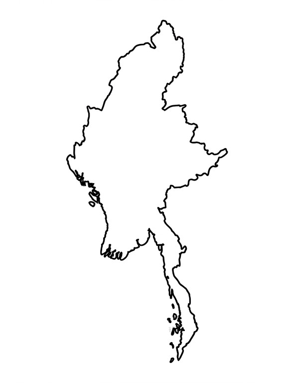
Download Free Blank Map of Myanmar
Looking for a Blank Map of Myanmar? You can download high-quality printable maps in PDF, PNG, JPG, and SVG formats from this page. These maps are perfect for school projects, geography lessons, travel planning, presentations, and research.
Our collection includes outline maps, printable maps, political maps, physical maps, river maps, and administrative maps. Each map is easy to print, simple to edit, and suitable for both personal and educational use.
Whether you are a student, teacher, traveler, or researcher, you can find the right Myanmar outline map for your needs.
What is a Blank Map of Myanmar?
A Blank Map of Myanmar is an unlabeled map showing the country’s outline and administrative boundaries without place names. It gives you a clean map that you can label, color, or customize for different purposes.
Blank maps are widely used in schools, colleges, and universities to teach geography. Teachers use them for classroom activities, while students use them to practice labeling states, cities, rivers, mountains, and neighboring countries. Professionals also use editable maps in reports, presentations, and planning projects.
Because the map has no labels, it is easy to customize for any learning or professional requirement.
Quick Facts About Myanmar
Before using a blank map, it helps to know some basic facts about the country.
| Feature | Details |
|---|---|
| Official Name | Republic of the Union of Myanmar |
| Capital | Naypyidaw |
| Largest City | Yangon |
| Region | Southeast Asia |
| Total Area | 676,578 km² |
| Population | About 55 Million |
| Official Language | Burmese |
| Currency | Myanmar Kyat (MMK) |
| Administrative Divisions | 7 States, 7 Regions & Naypyidaw Union Territory |
| Neighboring Countries | India, Bangladesh, China, Laos & Thailand |
| Coastline | Bay of Bengal & Andaman Sea |
| Highest Mountain | Hkakabo Razi |
| Longest River | Ayeyarwady (Irrawaddy) River |
These facts make it easier to understand Myanmar’s geography while using a printable blank map.
Why Download Our Blank Map of Myanmar?
Our maps are designed to be simple, accurate, and easy to use. Every map is created in high resolution so you can print it clearly or use it in digital projects.
Whether you need a Myanmar map without labels, a Myanmar map for students, or an editable Myanmar SVG map, you can download the format that works best for you.
Features
- High-resolution printable maps
- Accurate country outline
- Clear state and regional boundaries
- Available in PDF, PNG, JPG, and SVG
- Easy to print and edit
- Suitable for classrooms and presentations
- Free to download
- Updated administrative boundaries
Blank Map of Myanmar
The Blank Map of Myanmar shows the country’s outline without labels. It is one of the most useful resources for learning geography, planning projects, and creating custom maps. The clean layout allows you to add cities, states, rivers, roads, or any other information based on your needs.
This map is suitable for students, teachers, researchers, designers, and travelers. It can also be used for classroom worksheets, educational presentations, and geography practice.
Best For
- Geography assignments
- School projects
- Classroom activities
- Competitive exam preparation
- Travel planning
- Research work
- Presentations
Printable Blank Map of Myanmar
The Printable Blank Map of Myanmar is designed for easy printing on standard paper sizes such as A4 and A3. It provides clear boundaries and enough space to write labels, mark locations, or color different regions.
Students can use this map for homework and geography practice, while teachers can include it in classroom worksheets and quizzes. It is also useful for creating posters, reports, and presentations.
Best For
- School worksheets
- Geography homework
- Classroom quizzes
- Map-labeling practice
- Educational projects
- Office presentations
Available Formats
- PNG
- JPG
- SVG
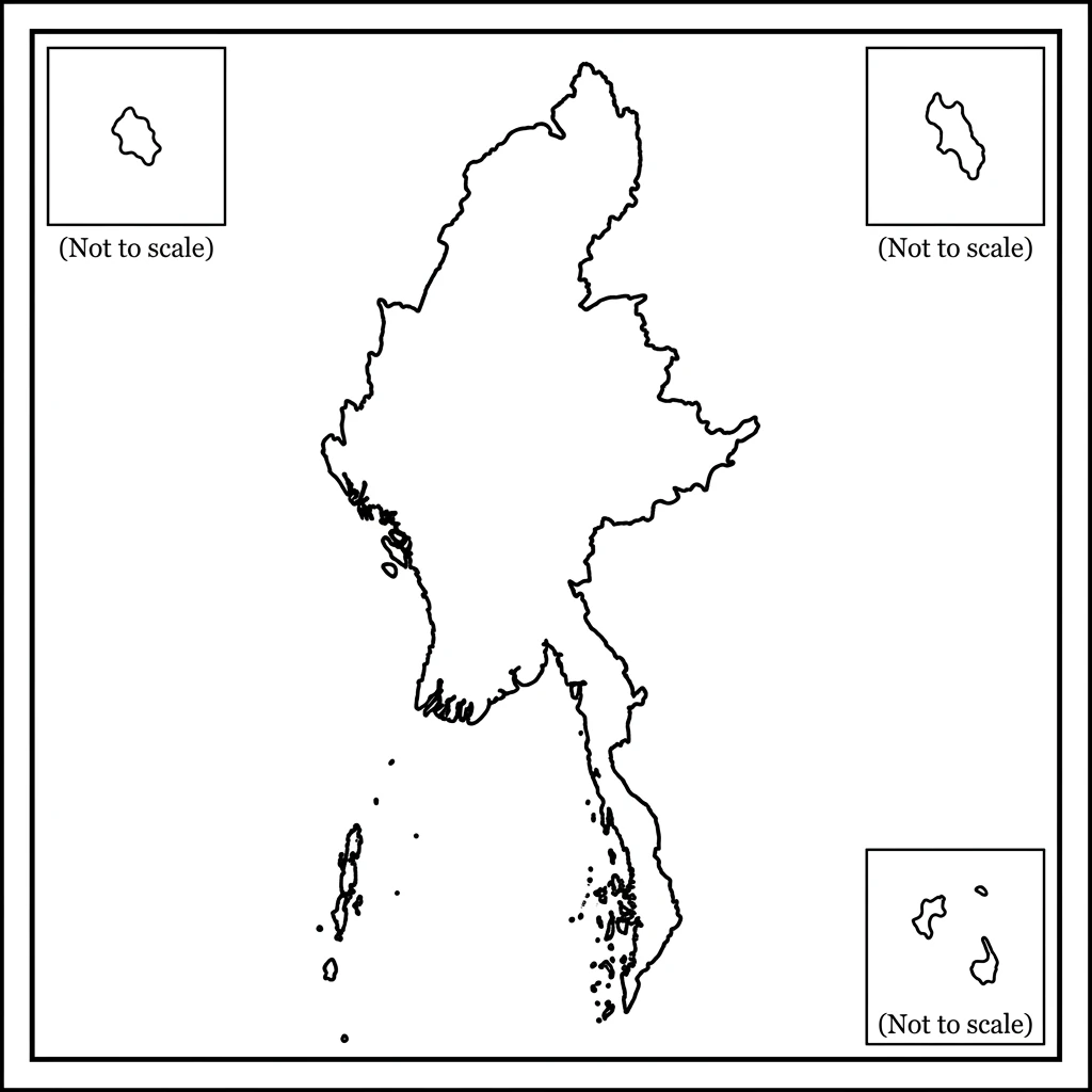
Outline Map of Myanmar
The Outline Map of Myanmar shows only the country’s outer boundary without labels or internal divisions. It is one of the simplest map types and is widely used for geography practice, classroom activities, and map-coloring exercises.
Students can use this map to identify Myanmar’s shape, mark neighboring countries, or label important cities and rivers. Teachers often include outline maps in worksheets, quizzes, and educational projects because they are easy to understand and customize.
Best For
- Country identification
- Geography practice
- Coloring activities
- School worksheets
- Classroom quizzes
- Educational projects
Blank Myanmar States & Regions Map
Myanmar is divided into 7 States, 7 Regions, and the Naypyidaw Union Territory. This Blank Myanmar States & Regions Map shows these administrative boundaries without labels, making it ideal for map-labeling practice.
Students can write the names of each state and region, while teachers can use the map for classroom exercises and geography tests. It is also useful for competitive exam preparation and regional studies.
Administrative Divisions
States
- Chin
- Kachin
- Kayah
- Kayin
- Mon
- Rakhine
- Shan
Regions
- Ayeyarwady
- Bago
- Magway
- Mandalay
- Sagaing
- Tanintharyi
- Yangon
Union Territory
- Naypyidaw
Best For
- State labeling
- Administrative geography
- School projects
- Classroom worksheets
- Competitive exams
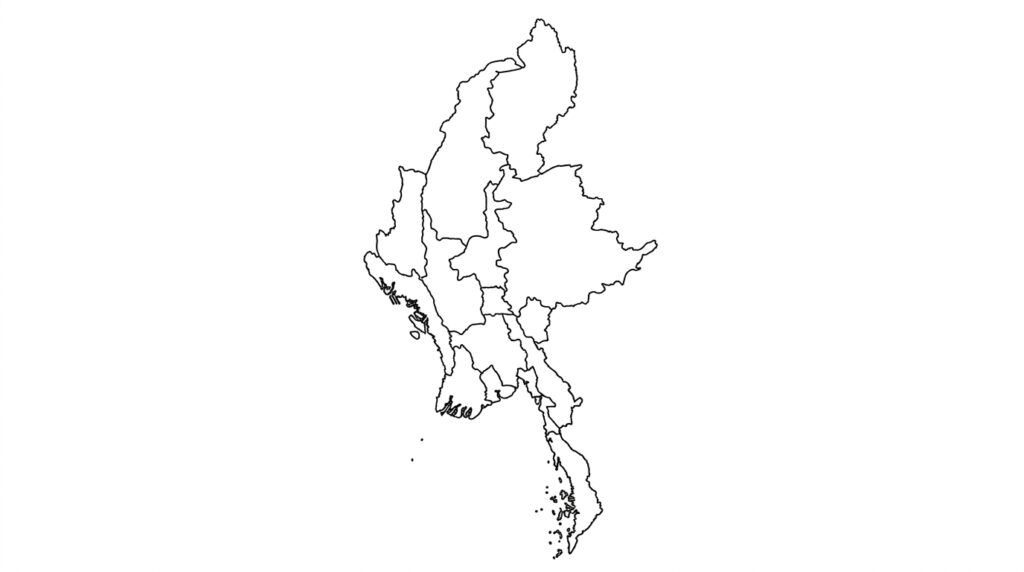
Blank Political Map of Myanmar
A Blank Political Map of Myanmar displays the country’s administrative boundaries without city or state names. It helps users understand Myanmar’s political divisions while giving them space to add their own labels.
This map is useful for schools, colleges, universities, and government-related studies. It is also a good choice for presentations and research projects that require a clean political map.
Best For
- Political geography
- Administrative studies
- Classroom presentations
- School assignments
- Research projects
Blank Physical Map of Myanmar
A Blank Physical Map of Myanmar highlights the country’s natural landscape. It can be used to study mountains, rivers, plains, plateaus, and coastal areas without extra labels.
Students often use this map to identify important landforms and understand how Myanmar’s geography affects climate, farming, and transportation.
Major Physical Features to Study
- Hkakabo Razi
- Arakan Mountains
- Shan Plateau
- Ayeyarwady River Basin
- Bay of Bengal
- Andaman Sea
Best For
- Physical geography
- Environmental studies
- School projects
- Geography practice
Blank Myanmar River Map
Myanmar has several major rivers that support farming, transportation, and daily life. A Blank Myanmar River Map helps students learn these waterways by labeling them on an unlabeled map.
It is commonly used in geography lessons, classroom quizzes, and environmental studies.
Major Rivers
| River | Importance |
|---|---|
| Ayeyarwady (Irrawaddy) | Longest and most important river |
| Chindwin | Largest tributary of the Ayeyarwady |
| Salween (Thanlwin) | One of Southeast Asia’s longest rivers |
| Sittaung | Important for agriculture |
| Kaladan | Regional transport and trade |
Best For
- River labeling
- Geography homework
- School projects
- Classroom activities
Blank Myanmar Map with Neighboring Countries
Myanmar shares borders with India, Bangladesh, China, Laos, and Thailand. This Blank Myanmar Map with Neighboring Countries helps users understand Myanmar’s location in Southeast Asia and identify the countries that surround it.
The map is useful for regional geography lessons, travel planning, and classroom activities.
| Country | Direction |
|---|---|
| India | Northwest |
| Bangladesh | West |
| China | North & Northeast |
| Laos | East |
| Thailand | Southeast |
Best For
- Border identification
- Regional geography
- School assignments
- Travel planning
Types of Blank Myanmar Maps
Different map types serve different purposes. Choose the one that best matches your learning or project needs.
| Map Type | Best Use |
|---|---|
| Blank Outline Map | Country shape and coloring |
| Printable Map | School worksheets |
| States & Regions Map | Administrative practice |
| Political Map | Political geography |
| Physical Map | Landforms and natural features |
| River Map | River identification |
| Neighboring Countries Map | Border studies |
Myanmar Geography Overview
Myanmar is located in Southeast Asia and covers an area of 676,578 square kilometers. The country has a diverse landscape that includes mountains, rivers, fertile plains, forests, and a long coastline. It shares borders with India, Bangladesh, China, Laos, and Thailand, making it an important country in the region.
The Ayeyarwady (Irrawaddy) River flows through the center of Myanmar and supports farming, transportation, and many major cities. In the north, Hkakabo Razi is the highest mountain in the country. The western coast borders the Bay of Bengal, while the southern coast meets the Andaman Sea.
A Blank Map of Myanmar is a great tool for learning about these natural and geographical features.
Major Cities of Myanmar
Myanmar has several important cities that play a key role in government, business, tourism, and culture. These cities are often marked during geography lessons and map-labeling activities.
| City | Importance |
|---|---|
| Naypyidaw | Capital of Myanmar |
| Yangon | Largest city and commercial center |
| Mandalay | Cultural and historical city |
| Bago | Important agricultural region |
| Mawlamyine | Major port city |
| Taunggyi | Capital of Shan State |
Practice locating these cities on a Blank Map of Myanmar to improve your geography skills.
Major Rivers of Myanmar
Myanmar has many rivers that support agriculture, transportation, fishing, and daily life. Learning these rivers helps students understand the country’s geography and economy.
| River | Importance |
|---|---|
| Ayeyarwady (Irrawaddy) | The longest river in Myanmar |
| Chindwin | Largest tributary of the Ayeyarwady |
| Salween (Thanlwin) | A major river in eastern Myanmar |
| Sittaung | Supports farming and irrigation |
| Kaladan | Important for regional trade |
Use the Blank Myanmar River Map to identify and label these rivers.
Major Mountains of Myanmar
Myanmar is home to several mountain ranges that shape its climate and natural environment. These mountains are important landmarks and are commonly studied in geography classes.
| Mountain | Location |
|---|---|
| Hkakabo Razi | Northern Myanmar |
| Arakan Mountains | Western Myanmar |
| Shan Plateau | Eastern Myanmar |
| Bago Yoma | Central Myanmar |
Students can mark these mountains on a Blank Physical Map of Myanmar to better understand the country’s landscape.
Available Download Formats
All maps on this page are available in multiple file formats. Choose the format that best matches your project.
| Format | Best For |
|---|---|
| High-quality printing | |
| PNG | Presentations and websites |
| JPG | School assignments and reports |
| SVG | Editing and graphic design |
Which Format Should You Choose?
- PDF – Best for printing on A4 or A3 paper.
- PNG – Ideal for presentations and websites.
- JPG – Suitable for reports and documents.
- SVG – Perfect for editing without losing quality.
Educational Uses
A Blank Map of Myanmar is widely used in schools, colleges, and universities. It helps students improve their map-reading skills and makes geography lessons more interactive.
Common Uses
- Geography assignments
- School projects
- Classroom quizzes
- Homework
- Map-labeling practice
- Competitive exam preparation
- Educational presentations
Teachers can also use printable maps to create worksheets and classroom activities.
Professional Uses
Blank maps are not only useful for education but also for professional work. Businesses, researchers, and organizations use them for planning and presentations.
Common Uses
- Business presentations
- Research projects
- Logistics planning
- Tourism planning
- Government reports
- NGO projects
- Data visualization
Editable SVG maps are especially useful for creating custom maps and presentations.
Myanmar Population Map – Myanmar Population of Men, Women, Children
| Region & State & Union Territory | Population | Men Population | Women Population | Children (0-14) | % of Total Population |
|---|---|---|---|---|---|
| Ayeyarwady | 6,184,000 | 2,986,000 | 3,198,000 | 1,609,000 | 11.2 |
| Ayeyarwady Region | 6,184,627 | 2,968,621 | 3,216,006 | 1,546,157 | 11.3 |
| Bago | 4,883,000 | 2,363,000 | 2,520,000 | 1,270,000 | 8.9 |
| Bago Region | 4,867,521 | 2,336,411 | 2,531,110 | 1,216,880 | 8.9 |
| Chin | 480,000 | 233,000 | 247,000 | 144,000 | 0.9 |
| Chin State | 478,801 | 229,824 | 248,977 | 119,700 | 0.9 |
| Kachin | 1,690,000 | 831,000 | 859,000 | 473,000 | 3.1 |
| Kachin State | 1,689,574 | 811,001 | 878,573 | 422,394 | 3.1 |
| Kayah | 355,000 | 176,000 | 179,000 | 99,000 | 0.6 |
| Kayah State | 286,627 | 137,581 | 149,046 | 71,657 | 0.5 |
| Kayin | 1,580,000 | 769,000 | 811,000 | 442,000 | 2.9 |
| Kayin State | 1,574,253 | 755,641 | 818,612 | 393,563 | 2.9 |
| Magway | 3,918,000 | 1,880,000 | 2,038,000 | 980,000 | 7.1 |
| Magway Region | 3,917,435 | 1,880,369 | 2,037,066 | 979,359 | 7.2 |
| Mandalay | 6,550,000 | 3,177,000 | 3,373,000 | 1,572,000 | 11.9 |
| Mandalay Region | 6,766,844 | 3,247,685 | 3,519,159 | 1,691,711 | 12.4 |
| Mon | 2,110,000 | 1,013,000 | 1,097,000 | 549,000 | 3.8 |
| Mon State | 2,054,398 | 986,111 | 1,068,287 | 513,600 | 3.8 |
| Naypyidaw | 1,320,000 | 648,000 | 672,000 | 356,000 | 2.4 |
| Naypyidaw Union Territory | 1,160,424 | 557,004 | 603,420 | 290,106 | 2.1 |
| Rakhine | 3,230,000 | 1,566,000 | 1,664,000 | 905,000 | 5.9 |
| Rakhine State | 3,188,751 | 1,530,601 | 1,658,150 | 797,188 | 5.8 |
| Sagaing | 5,420,000 | 2,620,000 | 2,800,000 | 1,409,000 | 9.8 |
| Sagaing Region | 5,325,931 | 2,556,447 | 2,769,484 | 1,331,483 | 9.7 |
| Shan | 6,300,000 | 3,119,000 | 3,181,000 | 1,764,000 | 11.4 |
| Shan State | 6,328,088 | 3,037,482 | 3,290,606 | 1,582,022 | 11.6 |
| Tanintharyi | 1,450,000 | 718,000 | 732,000 | 406,000 | 2.6 |
| Tanintharyi Region | 1,408,401 | 676,033 | 732,368 | 352,100 | 2.6 |
| Yangon | 8,600,000 | 4,128,000 | 4,472,000 | 1,892,000 | 15.6 |
| Yangon Region | 8,274,325 | 3,971,676 | 4,302,649 | 2,068,581 | 15.1 |
| TOTAL | 54,706,000 | 26,256,487 | 28,449,513 | 13,676,500 | 100 |
Geographical Myanmar Map – Myanmar Area Ranking in the World
Myanmar ranks 40th in the world, area-wise.
| Region & State & Union Territory | Capital | Area (sq km) | % of Total Area |
|---|---|---|---|
| Ayeyarwady | Pathein | 35,138 | 5.19 |
| Ayeyarwady Region | Pathein | 35,138 | 5.2 |
| Bago | Bago | 39,404 | 5.82 |
| Bago Region | Bago | 39,404 | 5.83 |
| Chin | Hakha | 36,019 | 5.32 |
| Chin State | Hakha | 36,019 | 5.33 |
| Kachin | Myitkyina | 89,041 | 13.16 |
| Kachin State | Myitkyina | 89,041 | 13.18 |
| Kayah | Loikaw | 11,731 | 1.73 |
| Kayah State | Loikaw | 11,733 | 1.74 |
| Kayin | Hpa-An | 30,383 | 4.49 |
| Kayin State | Hpa-An | 30,383 | 4.5 |
| Magway | Magway | 44,820 | 6.62 |
| Magway Region | Magway | 44,820 | 6.63 |
| Mandalay | Mandalay | 37,024 | 5.47 |
| Mandalay Region | Mandalay | 37,024 | 5.48 |
| Mon | Mawlamyine | 12,297 | 1.82 |
| Mon State | Mawlamyine | 12,297 | 1.82 |
| Naypyidaw | Naypyidaw | 7,054 | 1.04 |
| Naypyidaw Union Territory | Naypyidaw | 7,054 | 1.04 |
| Rakhine | Sittwe | 36,778 | 5.44 |
| Rakhine State | Sittwe | 36,778 | 5.44 |
| Sagaing | Sagaing | 93,527 | 13.82 |
| Sagaing Region | Sagaing | 94,625 | 14 |
| Shan | Taunggyi | 155,801 | 23.02 |
| Shan State | Taunggyi | 155,801 | 23.06 |
| Tanintharyi | Dawei | 43,345 | 6.4 |
| Tanintharyi Region | Dawei | 43,345 | 6.41 |
| Yangon | Yangon | 10,276 | 1.52 |
| Yangon Region | Yangon | 10,277 | 1.52 |
| TOTAL | 676,578 | 100 |
How to Download the Blank Map of Myanmar
Downloading your preferred map is simple. Follow these steps to get the format you need.
Step 1
Choose the map type you want to download.
- Blank Map
- Outline Map
- Political Map
- Physical Map
- River Map
- States & Regions Map
Step 2
Select your preferred file format.
- PNG
- JPG
- SVG
Step 3
Click the Download button.
Step 4
Save the file to your device and print or edit it whenever needed.
Printing Guide
All maps are designed for high-quality printing. Choose the paper size that best matches your project.
| Paper Size | Recommended Use |
|---|---|
| A4 | School assignments and worksheets |
| A3 | Classroom activities and presentations |
| Letter | Home and office printing |
| Legal | Reports and official documents |
| Poster | Wall displays and educational charts |
Printing Tips
- Print in Landscape mode for better visibility.
- Select High Quality in printer settings.
- Use Fit to Page to avoid cutting the map.
- Choose Color or Black & White based on your needs.
Frequently Asked Questions
1. What is a Blank Map of Myanmar?
A Blank Map of Myanmar is an unlabeled map showing the country’s outline and administrative boundaries. It is used for learning, labeling, and educational activities.
2. Is the Blank Map of Myanmar free to download?
Yes. All maps on this page are available as free downloads.
3. Which file formats are available?
You can download maps in PDF, PNG, JPG, and SVG formats.
4. Can I print the map?
Yes. All maps are print-ready and work well on A4, A3, Letter, and Legal paper sizes.
5. Which format is best for printing?
PDF is the best format for high-quality printing.
6. Which format is best for editing?
SVG is the best choice because it is fully editable without losing quality.
7. Does the map include states and regions?
Yes. A separate Blank Myanmar States & Regions Map is available for labeling and study.
8. Is this map suitable for students?
Yes. Students can use it for geography practice, homework, and school projects.
9. Can teachers use these maps?
Yes. Teachers often use printable maps for worksheets, quizzes, and classroom activities.
10. Does the map show rivers?
Yes. A Blank Myanmar River Map is available to help users study the country’s major rivers.
11. What is the capital of Myanmar?
The capital city of Myanmar is Naypyidaw.
12. Which countries border Myanmar?
Myanmar shares borders with India, Bangladesh, China, Laos, and Thailand.
13. Can I use the map for presentations?
Yes. PNG, JPG, and SVG formats are ideal for presentations and reports.
14. Is the map useful for competitive exams?
Yes. It is helpful for geography, general knowledge, and map-based questions in competitive exams.
15. Can children use this map?
Yes. Blank outline maps are perfect for coloring, labeling, and learning activities.
Download Your Blank Map of Myanmar Today
Whether you’re preparing for a school project, teaching a geography class, planning a trip, or creating a presentation, our Blank Map of Myanmar offers a simple, reliable way to explore the country.
Download your preferred map in PDF, PNG, JPG, or SVG format and start labeling states, cities, rivers, mountains, and neighboring countries with ease.
Choose the format that fits your needs, print it in high quality, and use it for learning, teaching, research, or professional work.