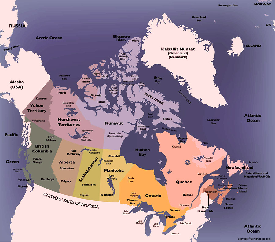
Canada, the second largest country in the world by land area, is a land of diverse landscapes and rich cultural heritage. A Labeled Canada Map showcases its 13 provinces and territories, each with its own unique geography, history, and cultural traditions. From the rugged coastlines of British Columbia and the rolling prairies of Saskatchewan to the dense forests of Quebec and the towering peaks of the Yukon, Canada offers a wealth of natural beauty to explore. Its major cities, including Toronto, Montreal, Vancouver, and Ottawa, are hubs of culture and commerce, known for their diverse communities, rich history, and vibrant arts scenes. With its friendly people, stunning landscapes, and rich cultural heritage, Canada is a truly unique and captivating destination.
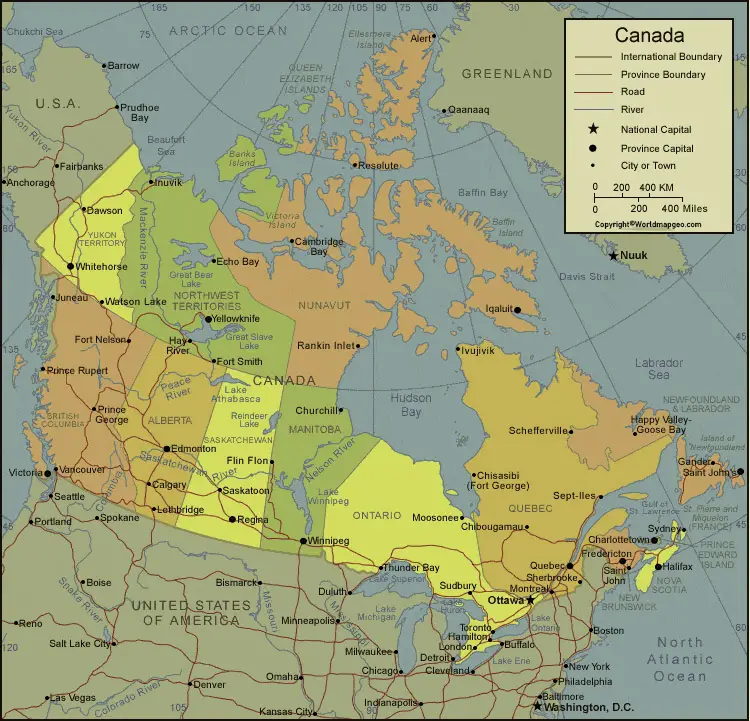
Labeled Canada Map
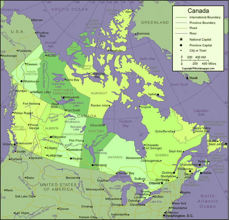
A labeled Canada map also includes major cities such as Vancouver, Montreal, and Calgary. These cities are economic hubs with their unique cultures, architecture, and attractions. For example, Vancouver is renowned for its natural beauty, while Montreal is known for its lively arts and music scene.
Bodies of water on a labeled Canada map include the Pacific Ocean, the Atlantic Ocean, the Arctic Ocean, and the Great Lakes. Canada has the world’s longest coastline, which extends over 200,000 kilometres, and there are more than 2 million lakes across the country.
In addition to its natural beauty, Canada is also famous for its landmarks and tourist attractions. A labeled Canada map usually includes these sites, which are must-see destinations for anyone visiting the country. These include the CN Tower in Toronto, the Parliament Buildings in Ottawa, Banff National Park, the Calgary Stampede, and Niagara Falls.
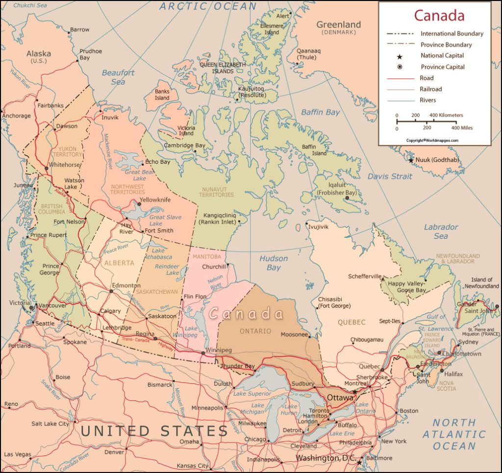
Canada Labeled Map With Capital
A labeled Canada map typically includes the country’s provinces and territories, major cities, bodies of water, and other important landmarks. The provinces and territories are usually colour-coded, making it easy to distinguish them from one another. There are ten provinces and three territories in Canada, each with its own unique features and attractions.
Ontario, Quebec, and British Columbia are the most populous provinces, and each has a distinct culture and landscape. Ontario is home to Toronto, the largest city in Canada, as well as the nation’s capital, Ottawa. Quebec is the only Canadian province with a predominantly French-speaking population, and it is renowned for its vibrant cultural scene, rich history, and delicious cuisine. British Columbia is known for its stunning natural beauty, including the Rocky Mountains, coastal rainforests, and crystal-clear lakes.
Canada Map With Cities Labeled
Other provinces and territories on a labeled Canada map include Alberta, Saskatchewan, Manitoba, New Brunswick, Prince Edward Island, Nova Scotia, Yukon, Northwest Territories, and Nunavut. These regions have unique features and attractions, including world-class skiing, vibrant festivals, and wildlife encounters.
Each capital city has its own unique history, cultural traditions, and geography, reflecting the diverse landscapes and rich cultural heritage of Canada. From the coastal charm of Victoria to the bustling cityscapes of Toronto and Quebec City, and the rugged beauty of Yellowknife, the capital cities of Canada offer a fascinating glimpse into the country’s diverse regions.
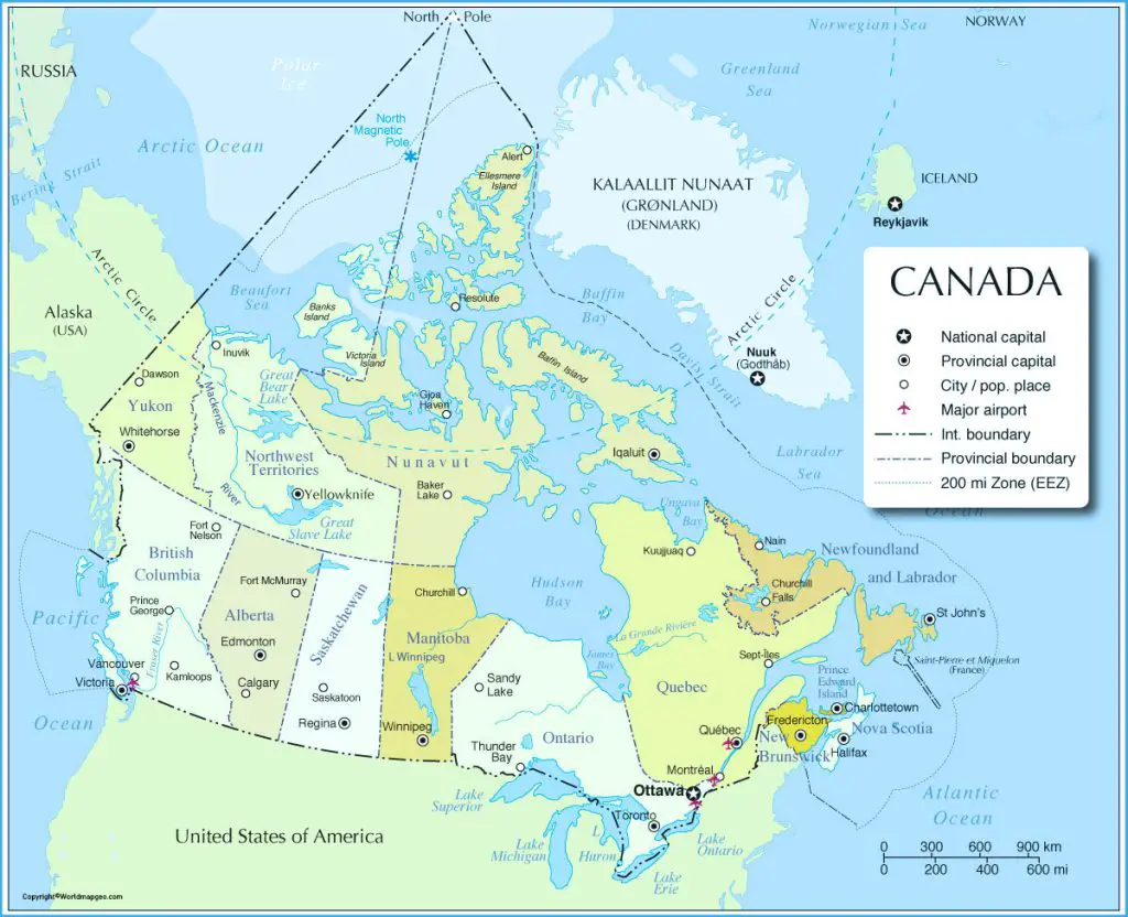
Labeled Canada Map With States
Canada, a country known for its vast landscapes and diverse cultural heritage, can be showcased through a labeled map highlighting its 13 provinces and territories and their capital cities. Some of the capital cities include:
- Victoria, British Columbia
- Edmonton, Alberta
- Regina, Saskatchewan
- Winnipeg, Manitoba
- Toronto, Ontario
- Quebec City, Quebec
- Fredericton, New Brunswick
- Halifax, Nova Scotia
- Charlottetown, Prince Edward Island
- St. John’s, Newfoundland and Labrador
- Whitehorse, Yukon
- Yellowknife, Northwest Territories
- Iqaluit, Nunavut
In conclusion, a labeled Canada map is an excellent resource for anyone interested in exploring this vast and diverse country. With its provinces and territories, major cities, bodies of water, and famous landmarks, a labeled Canada map provides a wealth of information about the country’s geography, culture, and history. Whether you’re planning a trip to Canada or simply want to expand your knowledge of this fascinating country, a labeled Canada map is a great place to start.