Labeled Czechia Map or Czech Republic Map -The Czech Republic, also known as Czechia, is a country located in Central Europe. It is bordered by Germany to the west, Poland to the northeast, Slovakia to the east, and Austria to the south. The country has a rich history and culture and is home to numerous landmarks and attractions. A labeled map of Czechia can help visitors and locals alike to better understand the geography of the country and plan their travels.
Labeled Czechia Map
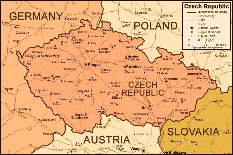
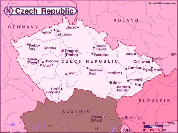
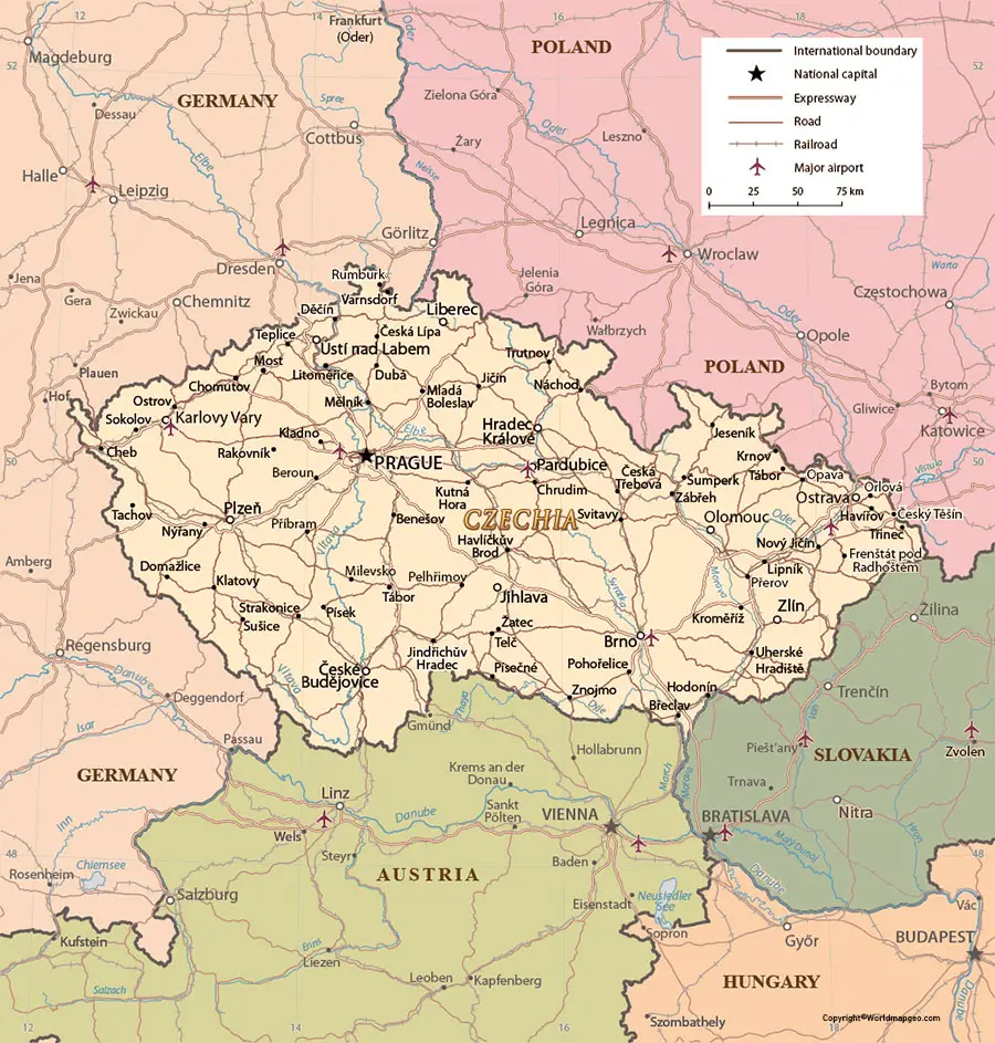
The Czech Republic is divided into 13 regions, each with its own unique characteristics and attractions. The capital city of Prague is located in the central region of Bohemia. This region is also home to other notable cities such as Pilsen, Karlovy Vary, and České Budějovice. Prague is one of the most popular tourist destinations in the country, known for its historic architecture, cultural landmarks, and vibrant nightlife. The city is located on the Vltava River, which flows through the heart of the city and is spanned by numerous iconic bridges.
To the north of Bohemia is the region of Liberec, which is known for its stunning natural beauty. The region is home to the Krkonoše Mountains, which form part of the Sudetes mountain range. The mountains are a popular destination for winter sports enthusiasts, as well as hikers and climbers in the warmer months. The city of Liberec itself is home to numerous landmarks, including the Liberec Town Hall and the Ještěd Tower.
Czechia (Czech Republic) Labeled Map With Capital
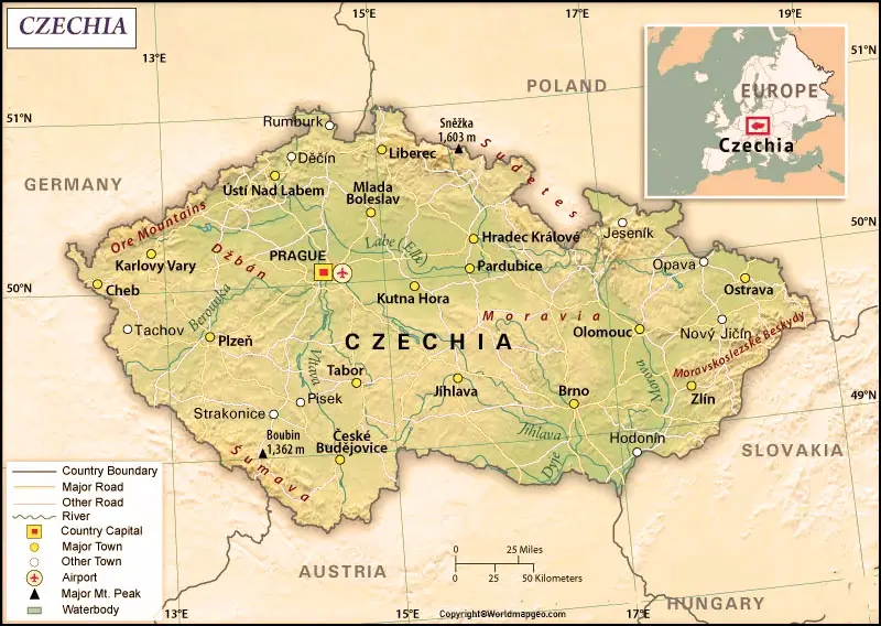
To the east of Bohemia is the region of Hradec Králové, which is known for its historic landmarks and natural beauty. The region is home to the Adršpach-Teplice Rocks, a series of towering sandstone formations that attract tourists from all over the world. The city of Hradec Králové is also home to numerous historic landmarks, including the Hradec Králové Castle and the Holy Spirit Cathedral.
To the east of Plzeň are the region of South Bohemia, which is known for its natural beauty and historic landmarks. The region is home to the Český Krumlov Castle, a UNESCO World Heritage Site that is considered one of the most beautiful castles in Europe. The region is also home to numerous lakes and rivers, making it a popular destination for water sports enthusiasts.
Czechia (Czech Republic) Map With States Labeled
To the east of South Bohemia is the region of Vysočina, which is known for its rolling hills and picturesque landscapes. The region is home to numerous historic landmarks, including the Telč Castle and the Jihlava Underground. The region is also home to numerous hiking and cycling trails, as well as ski resorts in the winter months.
To the south of Bohemia is the region of Plzeň, which is known for its beer. The city of Pilsen is the birthplace of Pilsner beer, and the region is home to numerous breweries and beer gardens. The region is also home to the Šumava Mountains, which form part of the Bohemian Forest. The mountains are a popular destination for hikers and nature enthusiasts, with numerous trails and scenic viewpoints.
Czechia (Czech Republic) Map With Cities Labeled
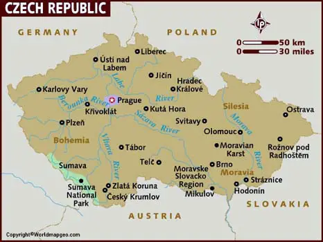
To the north of Bohemia are the region of Ústí nad Labem, which is known for its natural beauty and historic landmarks. The region is home to the Elbe Sandstone Mountains, a series of towering sandstone formations that attract hikers and climbers from all over the world. The region is also home to numerous historic landmarks, including the Terezín Concentration Camp and the Litoměřice Castle.
To the east of Ústí nad, Labem is the region of Moravia-Silesia, which is known for its industrial heritage and natural beauty.