This article is about the Missouri river map covering all essential characters. It extends from the Rocky Mountains in western Montana to its confluence with the Mississippi River north of St. Louis, Missouri. The river is approximately 2,341 miles long and drains an area of more than 500,000 square miles.
The Missouri River is a major source of water for drinking, irrigation, and industry. It is also a popular recreation destination for boating, fishing, and camping. Also, you can check out other world maps here with their image and pdf format such as:
Missouri River Map
The Missouri River is located in the Midwestern United States and flows from Montana to Missouri. The river is named after the Native American tribe that lived along its banks. The Missouri River was one of the main routes for westward expansion in the United States. Today, the river is a major source of recreation and transportation.
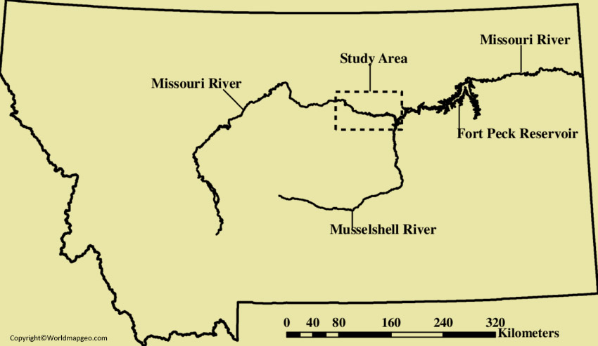
The Missouri River in Montana is a majestic waterway that spans across the state, offering breathtaking natural beauty and recreational opportunities. This river flows through diverse landscapes, including scenic canyons, expansive plains, and picturesque valleys. A Missouri River map of Montana would showcase key locations along the river, such as Great Falls, Fort Benton, and the Missouri Breaks National Monument.
Outdoor enthusiasts can enjoy activities like fishing, boating, and wildlife spotting while exploring the river’s meandering path. Whether you’re a nature lover or history enthusiast, the Missouri River in Montana promises an unforgettable experience amidst stunning surroundings. Check out other River Maps:- Nile River Map, Colorado River Map, Danube River Map.
Missouri River on Map
The United States of America would not be the same without the Missouri River. This river has played a vital role in the country’s history, from early exploration and westward expansion to present-day commerce and recreation. The Missouri River is one of the longest rivers in North America, and it continues to be an important part of American life.
The Missouri River, one of the longest rivers in North America, can be found on a map running through several states in the United States, including Montana. In Montana, the Missouri River winds its way through the state from west to east, passing through notable cities such as Helena, Great Falls, and Fort Benton.
On a map of Montana, you will see the Missouri River depicted as a blue line stretching across the state, cutting through valleys and carving its path through the diverse landscapes of the region. It is a prominent feature that adds to the natural beauty and recreational opportunities that Montana has to offer.
Where is the Missouri River Located on a Map
It rises in the Rocky Mountains of western Montana, United States, and flows east and south for 2,341 miles (3,767 km) before entering the Mississippi River north of St. Louis, Missouri.
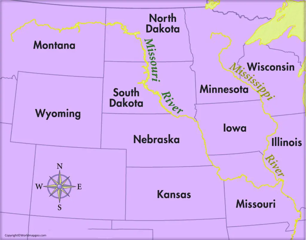
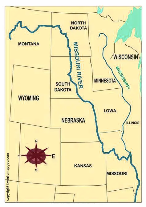
The Missouri River is located in the central part of the United States and runs through several states. It begins in the Rocky Mountains of western Montana and flows eastward, passing through the states of Montana, North Dakota, South Dakota, Nebraska, Iowa, Kansas, and Missouri.
The river eventually merges with the Mississippi River near St. Louis, Missouri. On a map, the Missouri River can be seen as a prominent blue line stretching from its source in Montana to its confluence with the Mississippi River in Missouri, traversing through various states along its course.
Map of Missouri River
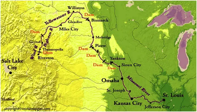
The main stem of the Missouri River is navigable by large barges and other vessels from its mouth to Kansas City, where the river becomes a tributary of the Kansas River. The Missouri River provides a vital link between the eastern and western parts of the country. The river bisects the country and provides a highway for commerce and trade.
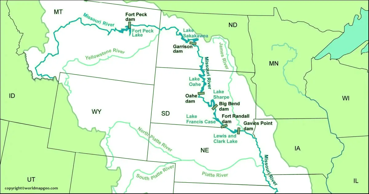
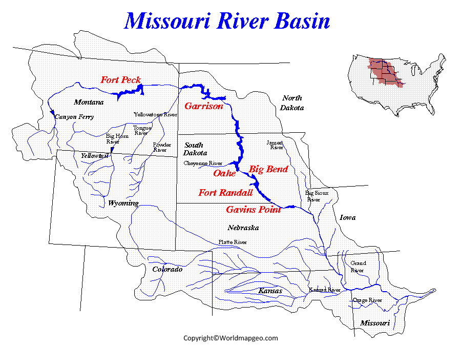
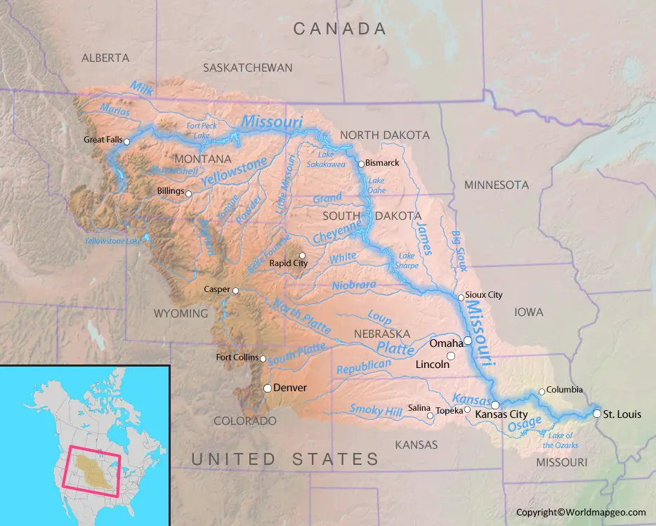
The map below shows the Missouri River and its major tributaries. The river and its tributaries drain a large portion of the central United States, including all of North Dakota, South Dakota, Nebraska, Kansas, and Missouri.
The Missouri River is one of the most iconic rivers in America. It has been a key part of American history, from the early days of exploration and westward expansion to its present-day role as a major shipping route. The river is also home to some of the country’s most famous landmarks, including the Gateway Arch in St. Louis and Independence Hall in Kansas City. Here are just a few of the many famous places along the Missouri River.
Missouri River Map Montana
The Map of Missouri River provides an essential visual representation of this iconic waterway as it winds its way through several states in the United States. The Missouri River is the longest river in North America, stretching over 2,300 miles from its source in the Rocky Mountains of Montana to its confluence with the Mississippi River in Missouri.
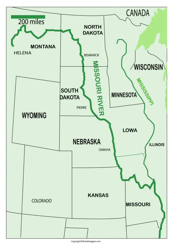
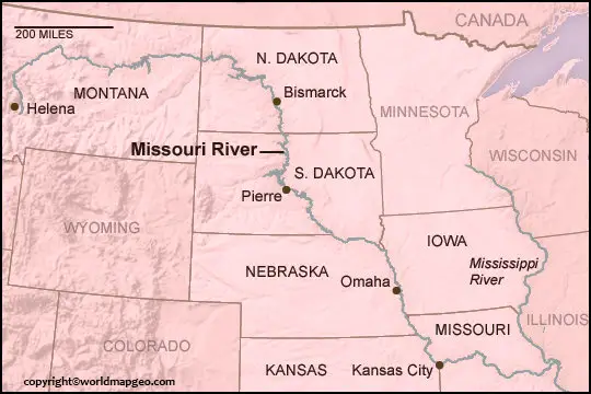
The map showcases the course of the Missouri River, highlighting major cities and landmarks along its path. Starting in Montana, the river flows through cities such as Great Falls and Helena, passing through the breathtaking landscapes of the Montana plains and canyons. As it continues eastward, the river travels through North Dakota. Where it passes by Bismarck and the famous Lewis and Clark Interpretive Center.
Entering South Dakota, the Missouri River meanders past Pierre, the state capital. And alongside the awe-inspiring Badlands National Park. Further downstream, the river flows through the city of Sioux City in Iowa, eventually reaching Nebraska. Where it passes Omaha and provides a picturesque backdrop for outdoor recreation.
The Missouri River then forms the border between Nebraska and Kansas before flowing through the scenic and historic Kansas City. Continuing east, it traverses the states of Missouri and Illinois, passing by St. Louis, where it joins the mighty Mississippi River.
This map of the Missouri River serves as a valuable resource for adventurers, historians, and nature enthusiasts alike. It offers a clear overview of the river’s path. And its significance as a major waterway in the heartland of the United States. Whether you’re planning a river excursion, studying the river’s historical importance. Or simply exploring the regions it touches, the Missouri River map provides a comprehensive guide to this remarkable natural feature.