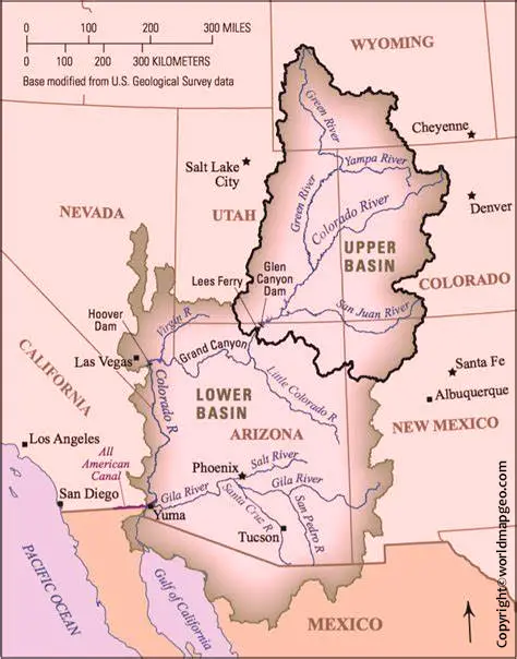
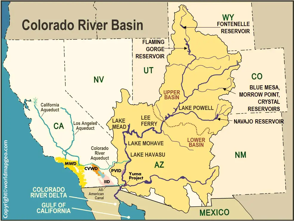
The Colorado River Map is one of the most iconic rivers in North America. It is also one of the most important rivers in the southwestern United States. The Colorado River basin covers parts of seven states, including Colorado, Wyoming, Utah, New Mexico, Nevada, Arizona, and California.
| Feature | Details |
|---|---|
| River Name | Colorado River |
| Length | Approx. 1,450 miles (2,330 km) |
| Source | Rocky Mountains, Colorado (La Poudre Pass Lake) |
| Mouth | Gulf of California (Mexico) |
| Countries | United States, Mexico |
| States Covered | Colorado, Utah, Arizona, Nevada, California, Wyoming, New Mexico |
| River System | Colorado River Basin |
| Type | Perennial River |
| Major Use | Drinking water, irrigation, and hydroelectric power |
Colorado River Map
The river is important for irrigation, drinking water, hydropower, and recreation. Humans have had a profound impact on the Colorado River environment. dams, irrigation, and other water diversions have changed the river’s flow and ecosystem. These changes have led to declining water quality and quantity, as well as habitat loss and degradation. Also, you can check out other world maps here with their image and pdf format such as:
Related Post –
- Blank Map of Eritrea
- BlankMap of Estonia
- Blank Map of Eswatini
- BlankMap of Ethiopia
- BlankMap of Gambia
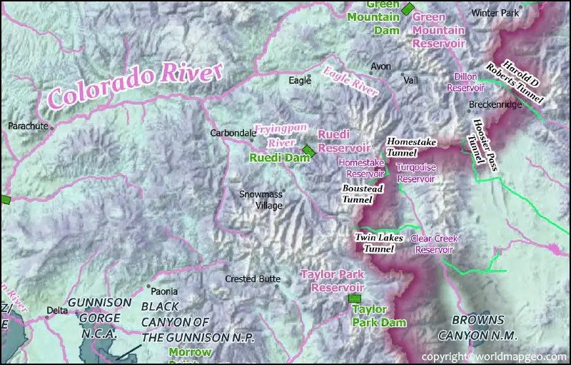
Colorado River on Map
The Colorado River is about 1,450 miles long and starts in the Rocky Mountains of Colorado. The river flows through canyons and valleys in the southwest United States before emptying into the Gulf of California. In recent years, the river has been threatened by drought and climate change. The Colorado River is one of the most important watersheds in the American West. The river and its tributaries provide water to more than 40 million people in seven US states. The river is also a critical habitat for a wide variety of plants and animals.
Map of Colorado River
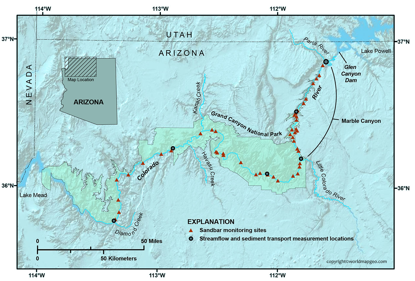
The Colorado River shows all of the major rapids and highlights some of the best places to camp along the way. The river is also home to a wide variety of wildlife and is a popular destination for both leisure and commercial activity. The Colorado River is an important part of the history and culture of the American West, and it continues to play a vital role in the region today.
The Colorado River flows through seven states in the southwestern United States and Mexico. The Colorado River is 1,450 miles long and is a major source of water for these arid regions. The river provides irrigation water for crops, drinking water for cities, and hydroelectric power for homes and industry. It is also a popular recreation destination, with millions of people visiting each year to raft, fish, and hike along its banks.
Colorado River Basin Map
The Colorado River basin is a large area of land in the western United States that includes parts of seven states. The river itself is one of the most important waterways in the country, providing water to millions of people and irrigating thousands of acres of farmland. The basin is also home to a variety of wildlife, including several endangered species.
Though most of the river is relatively shallow, there are a few stretches where it is deep enough to support navigation by boat. The first recorded instance of navigation on the Colorado River was by Spanish explorer Francisco de Ulloa in 1539.
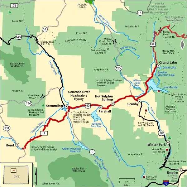
Where is the Colorado River on a Map
The river begins in the Rocky Mountains of Colorado and flows all the way to Mexico where it empties into the Gulf of California. The Colorado River is one of the most iconic features of the American West. The river has its origins in the Rocky Mountains of Colorado, and it winds its way through canyons and desert landscapes before emptying into the Gulf of California. The Colorado River is an important source of water for the southwestern United States, and it is also a popular recreation destination for kayakers, rafters, and fishermen.
FAQs
1. Where is the Colorado River located on the map?
The Colorado River runs through the south-west of the United States and nor-western Mexico. It runs from the Rocky Mountains in Colorado, through seven states in the United States and meets the Gulf of California.
2. Which states does the Colorado River pass through?
It is one of the most important water sources in the western United States and runs through Colorado, Wyoming, Utah, New Mexico, Nevada, Arizona and California.
3. What is the source and mouth of the Colorado River?
The river drains from La Poudre Pass Lake in the Rocky Mountains, Colorado to the Gulf of California (Mexico), which was once a delta area.
4. What are the major dams shown on the Colorado River map?
Hoover Dam, Glen Canyon Dam, Parker Dam, and Imperial Dam are important dams used for generating hydroelectric power, storing water, and providing irrigation water.
5. Why is the Colorado River important?
The Colorado River is vital for drinking water supplies, agriculture, power generation, and ecosystem services. Supplies water to more than 40 million people in the south-western part of the United States and Mexico.